Looking for Country
Blackwattle Bay (Tjerruing) Catchment & Glebe Point Road
2025
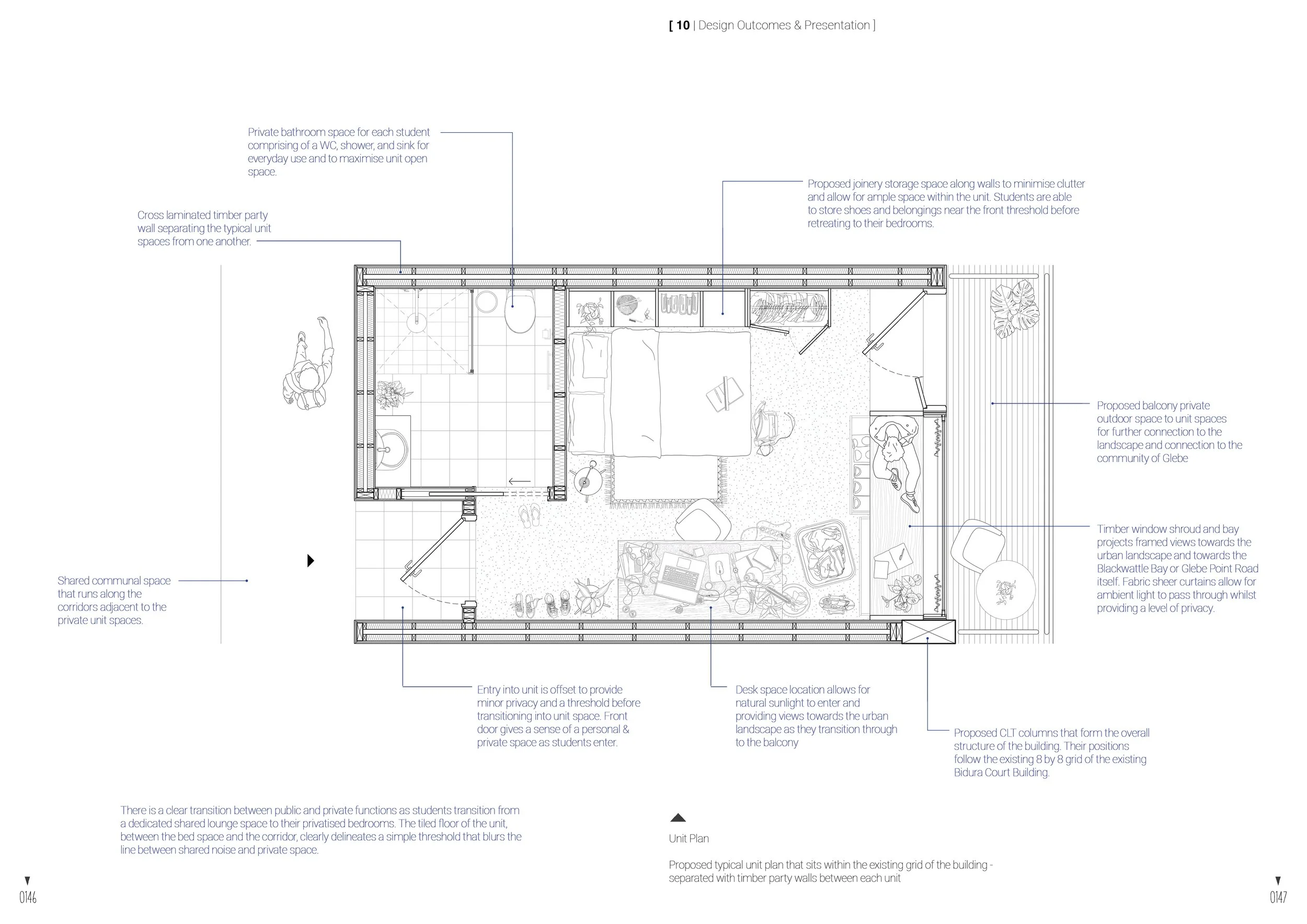
Precinct Masterplan and Student Social Housing
Project with Natania Sitoe & William Roebuck
TJERRUING
Bird’s Eye View of Blackwattle Bay (Tjerruing)
The project brief outlines the aim to research and heavily integrate notions of Country within the existing Blackwattle Bay catchment and urban landscape; and imagining the conditions between this concept through spaces of socialising, communities within the site, and thresholds that carefully transition people between the existing and pre-existing Blackwattle Creek. This relationship, paired with site investigations and the impact of the development of the catchment promotes thought on designing spaces through daylighting and laneways whilst developing a strong understanding of user values, shedding light on the site’s necessities and as the public utilises these proposed spaces.
By focusing and honing in on the brief, an attempt to create a scheme that enhances the catchment’s desire for a multitude of both intimate micro and macro spaces, but also incorporating areas for interactions with the site itself. This perception of socialising and gathering spaces is distinguishably highlighted by the gradience of a shared populated space that slowly transitions into intimate interstitual areas within the less-activated streets within the Blackwattle Bay catchment.
The result, in this case, a programmatic scheme that effectively responds to these activities of living but also incorporates notions of Country and connections to the water and landscape to provide ample in-between spaces without compromising on natural light, views to Blackwattle Bay or connections with nature and site history. Ultimatey, this project aims to strengthen and preserve it’s Connections to Country and it’s history for its inhabitants and thus, facilitate a community of shared knowledge and presentation to the public.
This project hopes to create a functioning precinct within the Blackwattle Bay catchment area by repurposing the developong existing streetscapes, utilising key principles of Country and Indigenous history, responding to the existing site, project brief, and thus, develop a conceptual framework that evolves over time for the next few generations of its inhabitants. The aim was to further establish ways people can interact and transition within the site and create a precinct of socialising, travel, and the celebration of the catchment’s history.
Mapping
·
Country & Indigenous History
·
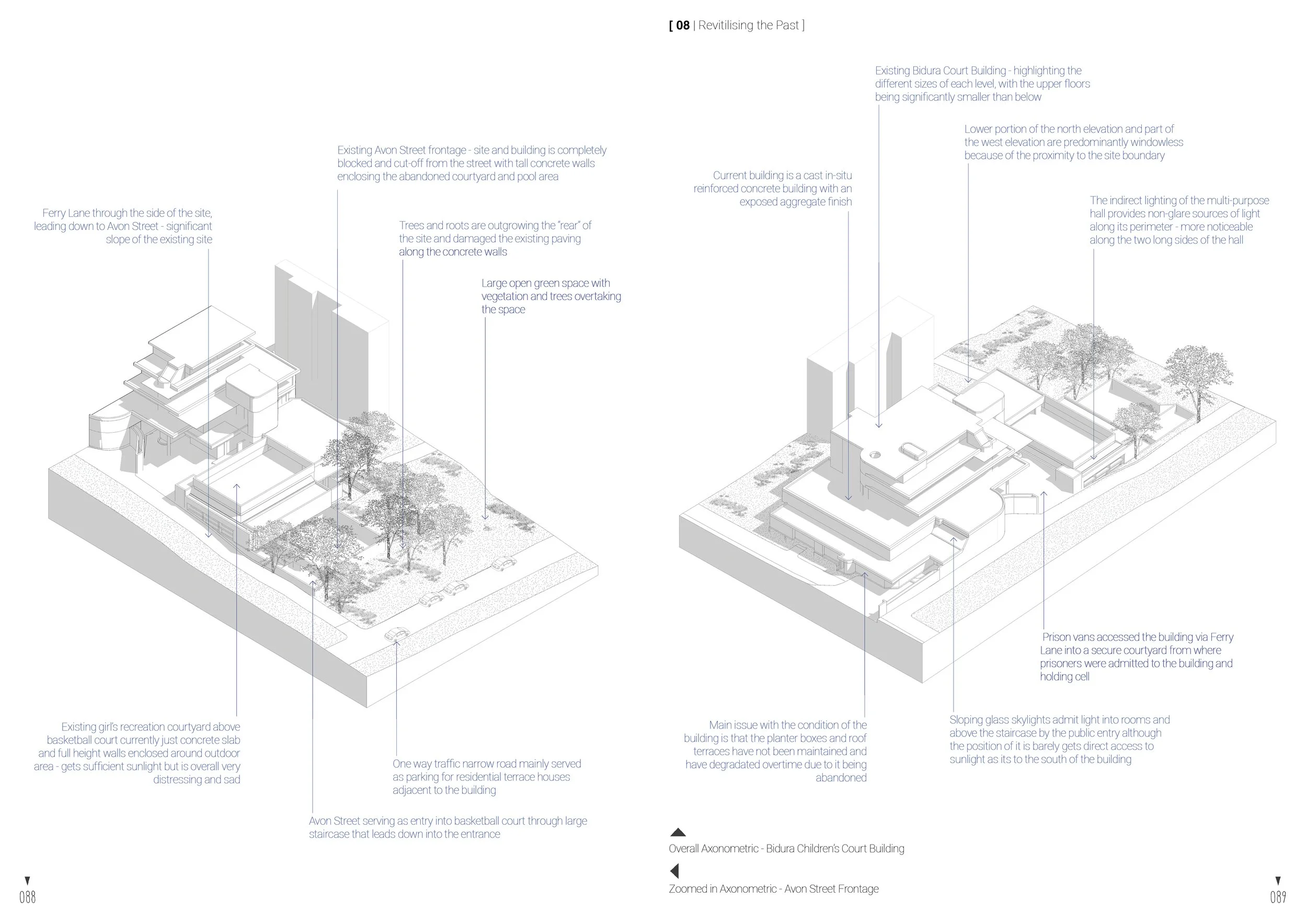
Revitilising the Past
·
Mapping · Country & Indigenous History · Revitilising the Past ·
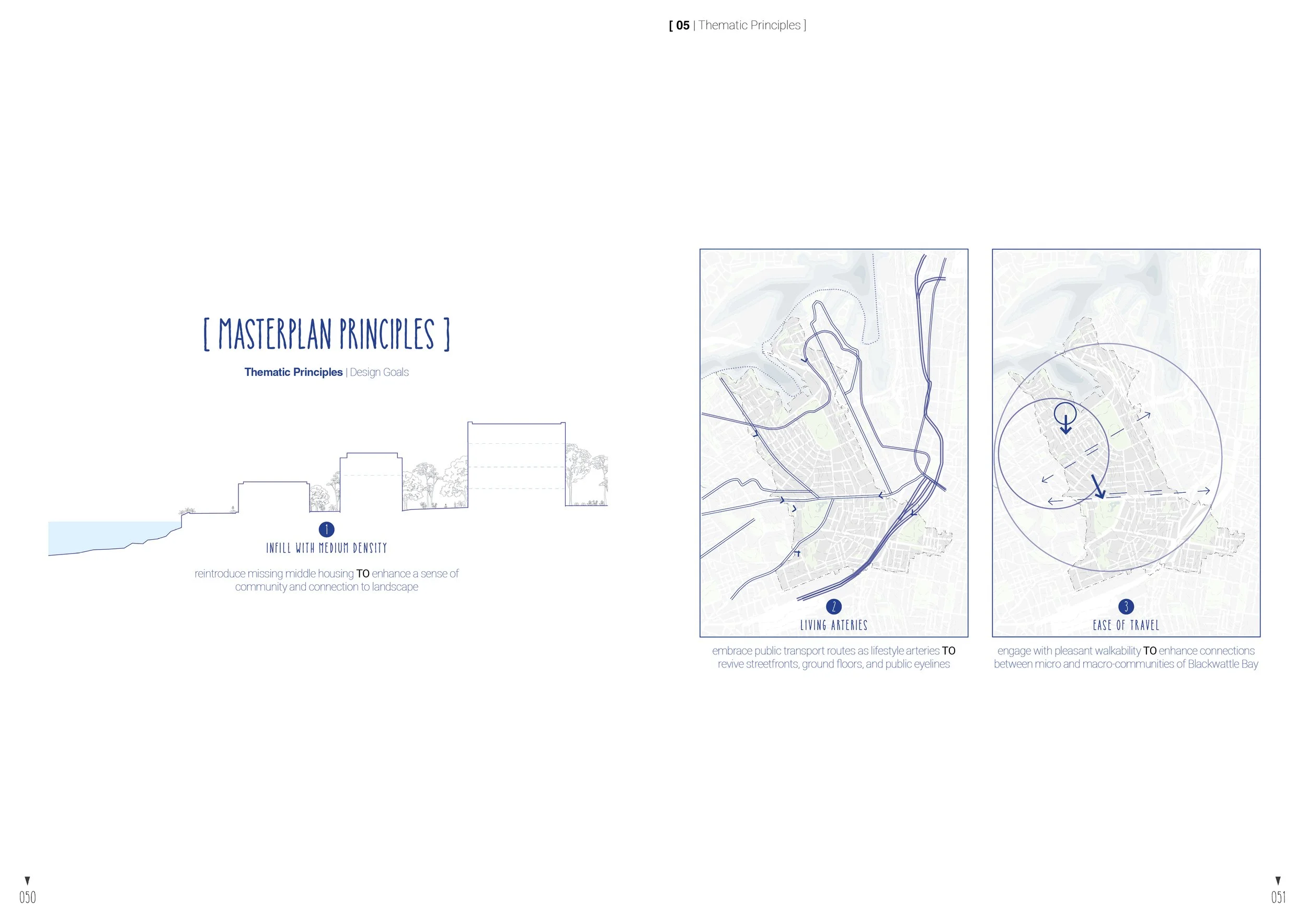
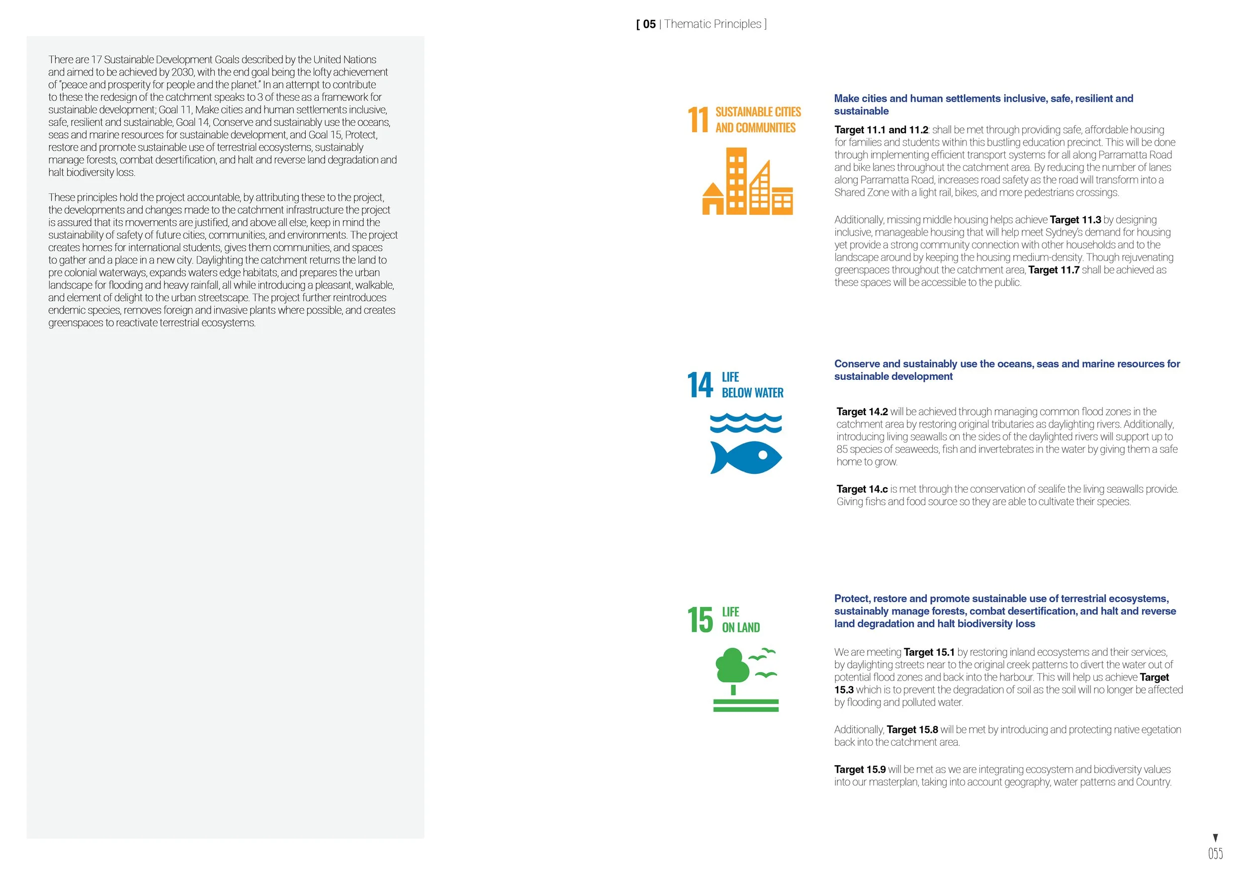
Thematic Principles
-

Aboriginal Architecture
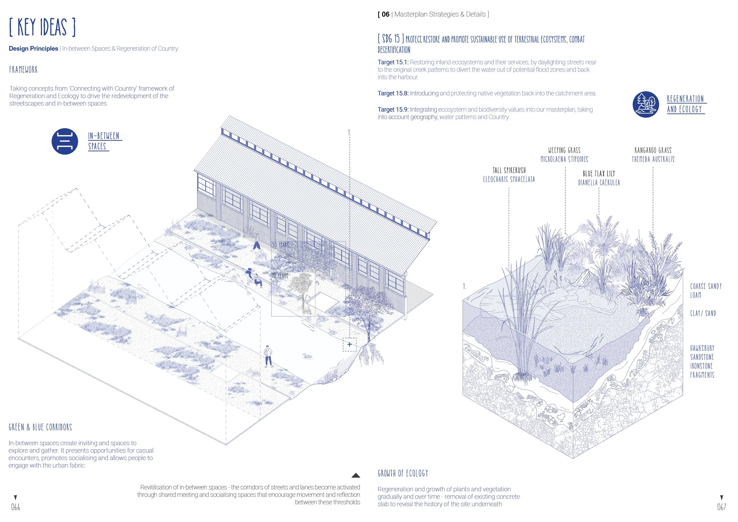
creating green and blue corridors TO restore and embed the memory of place
-

Indirect Connections
provide ample views and interaction towards the site’s features and streetscape TO connect to landscape
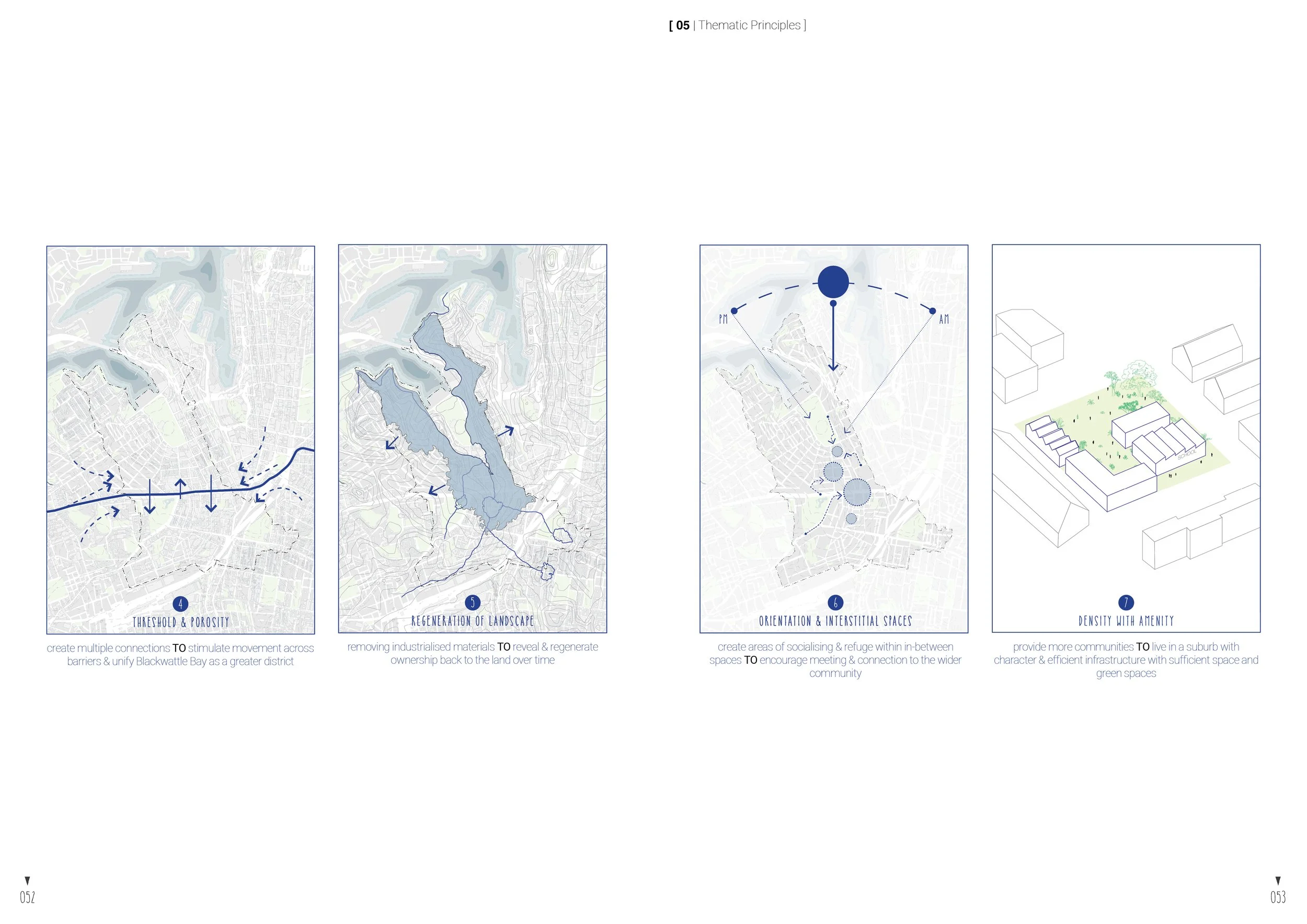
-

Inbetween Spaces
interstitial spaces TO encourage gathering and connection with the wider community
-

Regeneration
removing industrialised materials TO restore and regenerate ownership back to the land
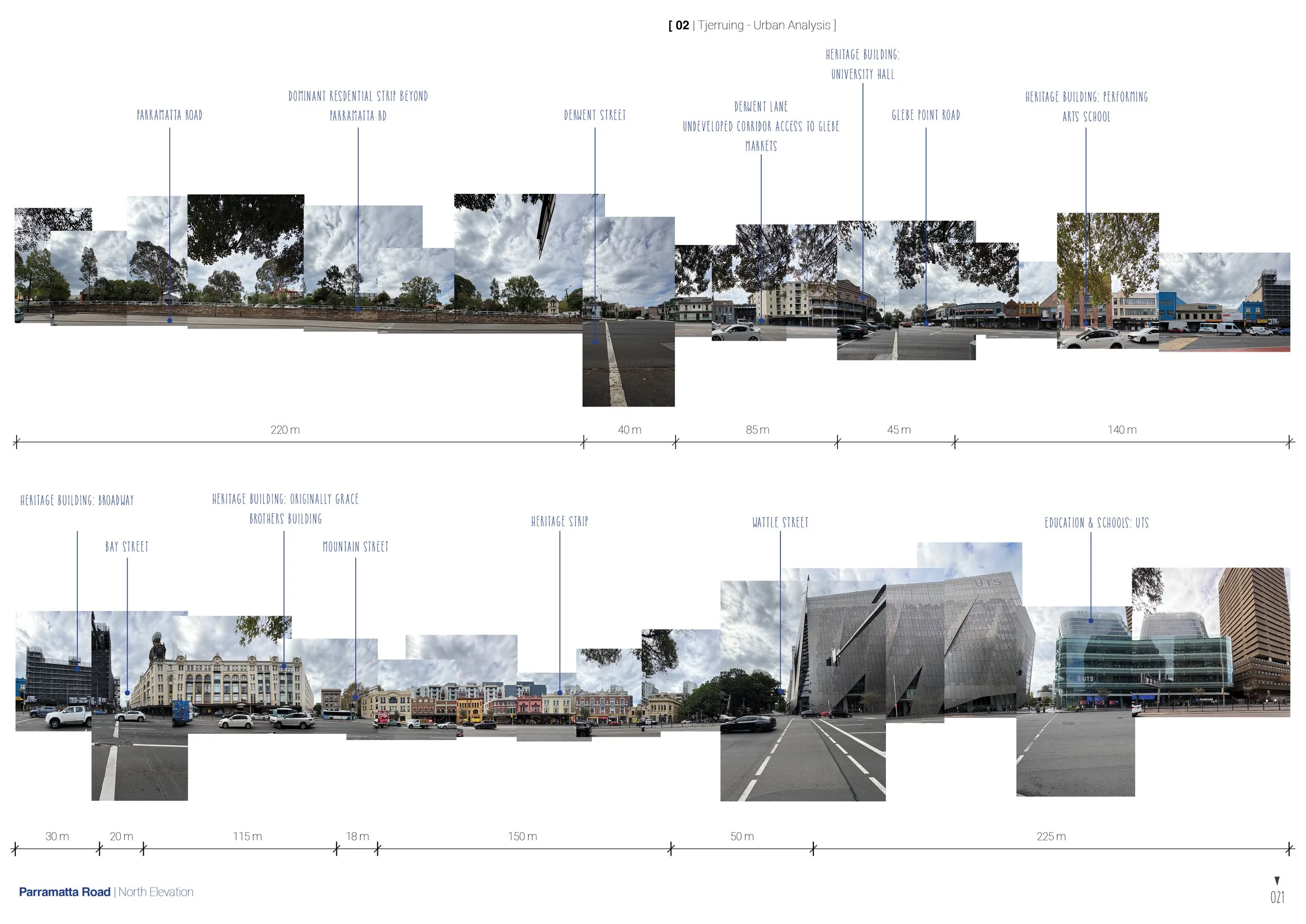
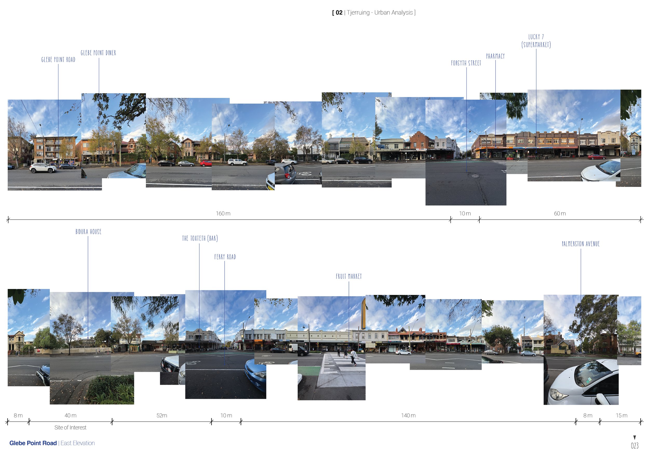
MAPPING
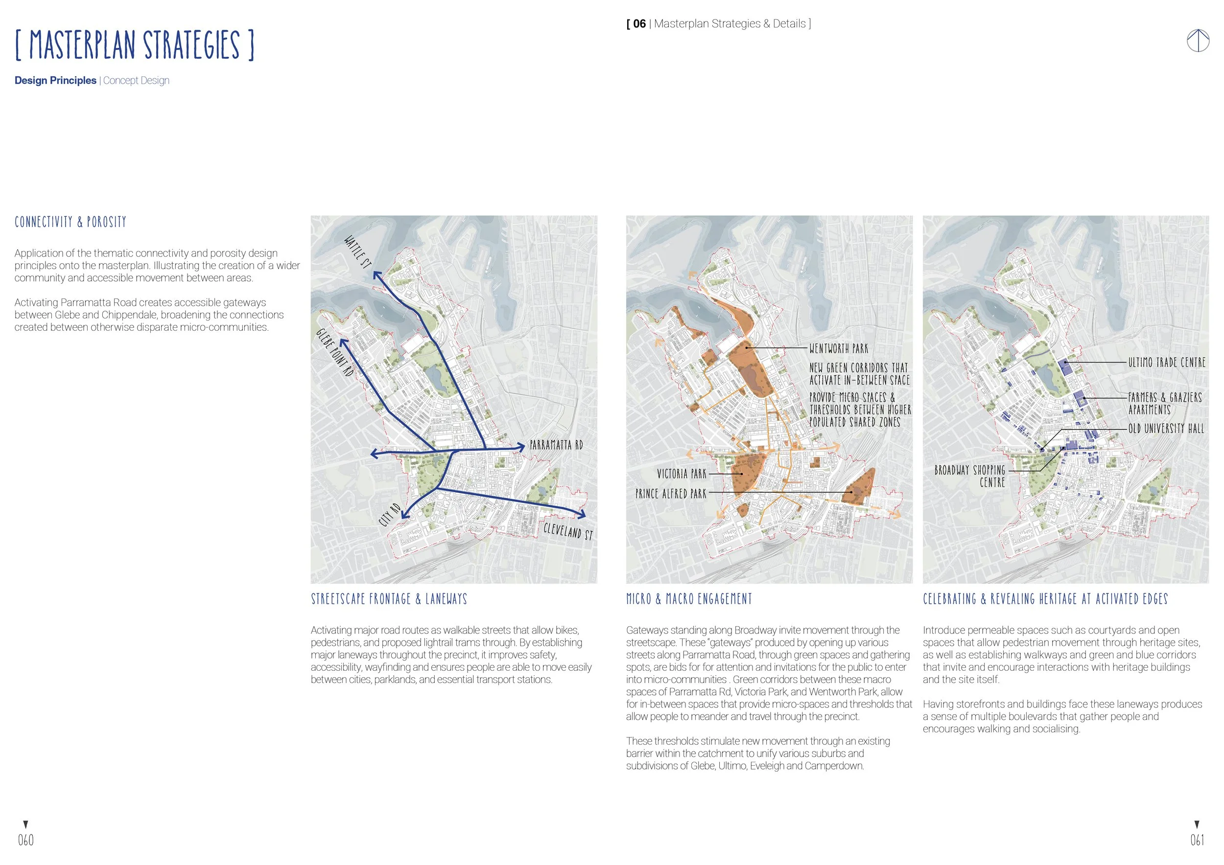
Mapping of most populated areas within the Blackwattle Bay catchment allowed for greater insight into deermining spaces for enhanced transport access, proposed laneways, and potential gathering zones.
Most identified populated and densified spaces followed along Parramatta Road, Glebe Point Road, and Wattle Street, where large pedestrian and main vehicular traffic occupied the space.
In February 2025, NSW Planning update the Low and Mid-Rise Housing Policy. The policy updates aims to encourage more low/medium rise housing to be built within a 800 meter walk from public transport and suburb centers.
TJERRUING BLACKWATTLE BAY
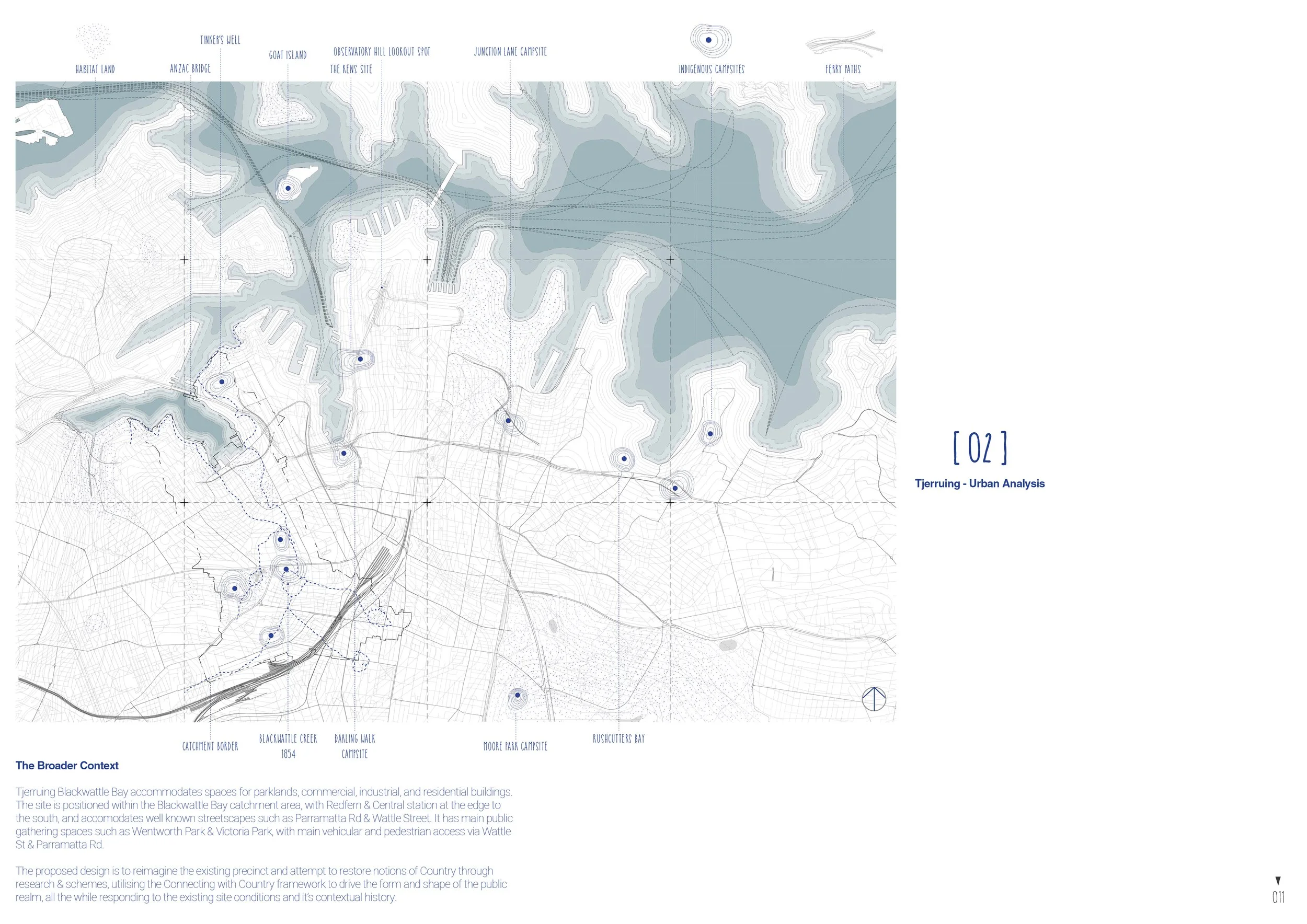
Named after its distinct trees that grew along the foreshores of Blackwatle Creek, Tjerruing Blackwattle Bay is home to a variety of commercial, industrial, and residential buildings that permeate throughout the catchment. Presently, there are a multitude of parklands that are scattered througout the site, with noticeable parks such as Wentworth and Victoria Park located on the grounds of where Blackwattle Creek used to reside, with Lake Northam in Victoria Park being a large reminder of the creek.
Our analysis and mapping acknowledges the past and present as we strive to design for a future in 100 years time where history and Country is prevalent throughout the catchment. The mapping identifies core values of movement, histroy and the morphology of the site which aids us in the attempt to restore and reclaim owndership back to the land.
Existing Conditions
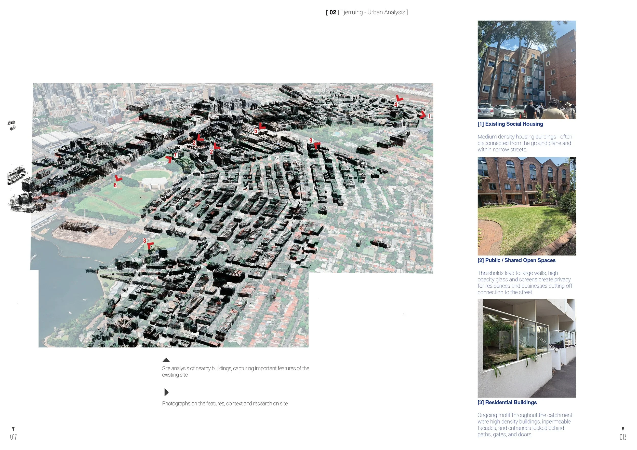
Proposed Masterplan
“Country is more than just an idea. It is related to the origins of the landscapes that we inhabit and therefore our own origins..”
- Danièle Hromek
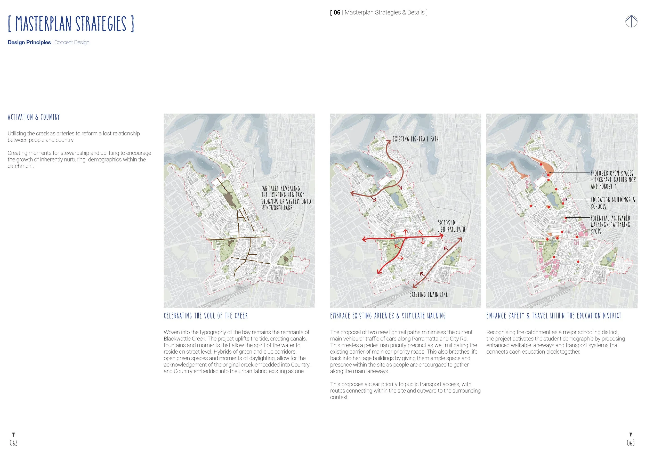
The form of the pre-existing Blackwattle Creek is adopted into the landscape of the Wentworth Park, as it weaves around the open landscape area and connects to Victoria Park through various green and blue corridors.
TJERRUING BLACKWATTLE BAY
Connecting the suburbs of Glebe, Chippendale, Ultimo and Eveleigh. The catchment spans from the Pyrmont headlands across Johnston’s Bay to Glebe, and back to North Eveleigh. Home to a wide range of diverse sub-divisions, residential, commercial, educational and parkland districts. The masterplan sees to connect all these into a harmonious macro community defined by its place in the catchment. Connecting the far reaches of the catchment, Blackwattle creek runs through a series of daylighted rivers, canals and fountains. Along with the daylighted blue spaces, greenspaces sprout up within the catchment. Paying specific attention to public transport networks, increased amenity with density finds it home along these paths. Creating public community and connection to each other. The gateways along Parramatta road open up the busy junction both ways for easier pedestrian crossing. The implementation of a light rail and removal of cars create a safer street and support public transport and walking. The increase in ammenities on either side will encourage crossing between subdivisions. The masterplan also sees the redevelopment of Wentworth Park and a major revitalisation of Country in the otherwise manmade parkland, bringing Country back to the water’s edge continuing along to the shorefront promenade.
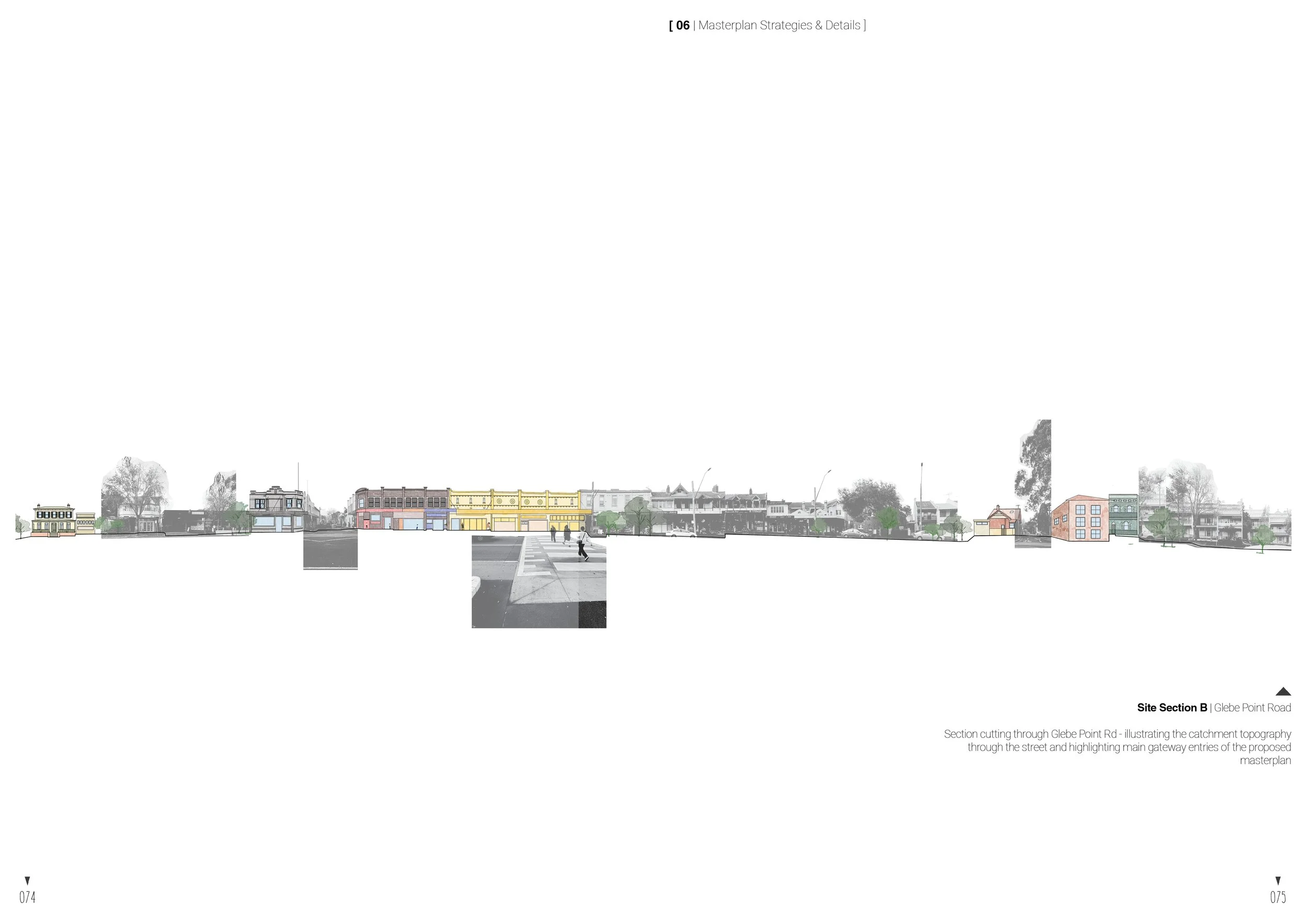
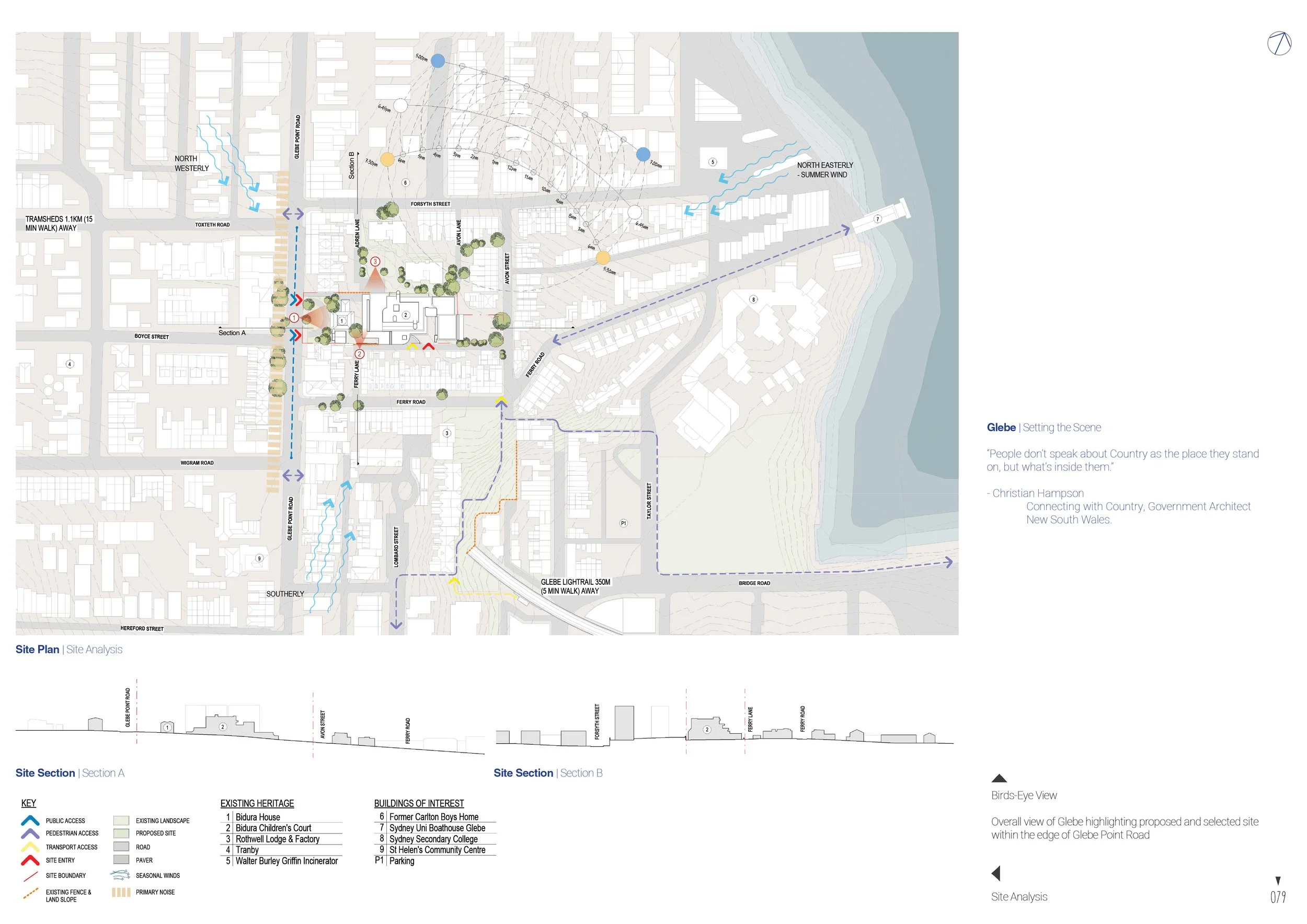
GLEBE POINT ROAD - SETTING THE SCENE
Glebe, originates from the name for land granted to the church, and as such Glebe was part of a vast Church owned estate after the colonisation of Sydney Cove, granted by Governor Arthur Phillip in 1790. The original estate was 400 acres owned by the Anglican Church and the area remained largely undeveloped as such into the 19th century. The estate was subdivided into wealthy-owned villas, a fact which can be seen in the ongoing density and streetscape of the suburb.
A major community push against the development of expressway constructions and suburb wide redevelopment in the 1960s and 70s, left many of the homes becoming heritage listed and much of this era’s community character preserved. Present day Glebe is still home to many of these structures and stylings, however, major concern for gentrification, the loss of accessibility to inner city housing to low income households, and individuals is on the rise. Glebe Point Road has long been a major artery, even pre colonisation in which the ridge line provided vantage points for local Indigenous communities.
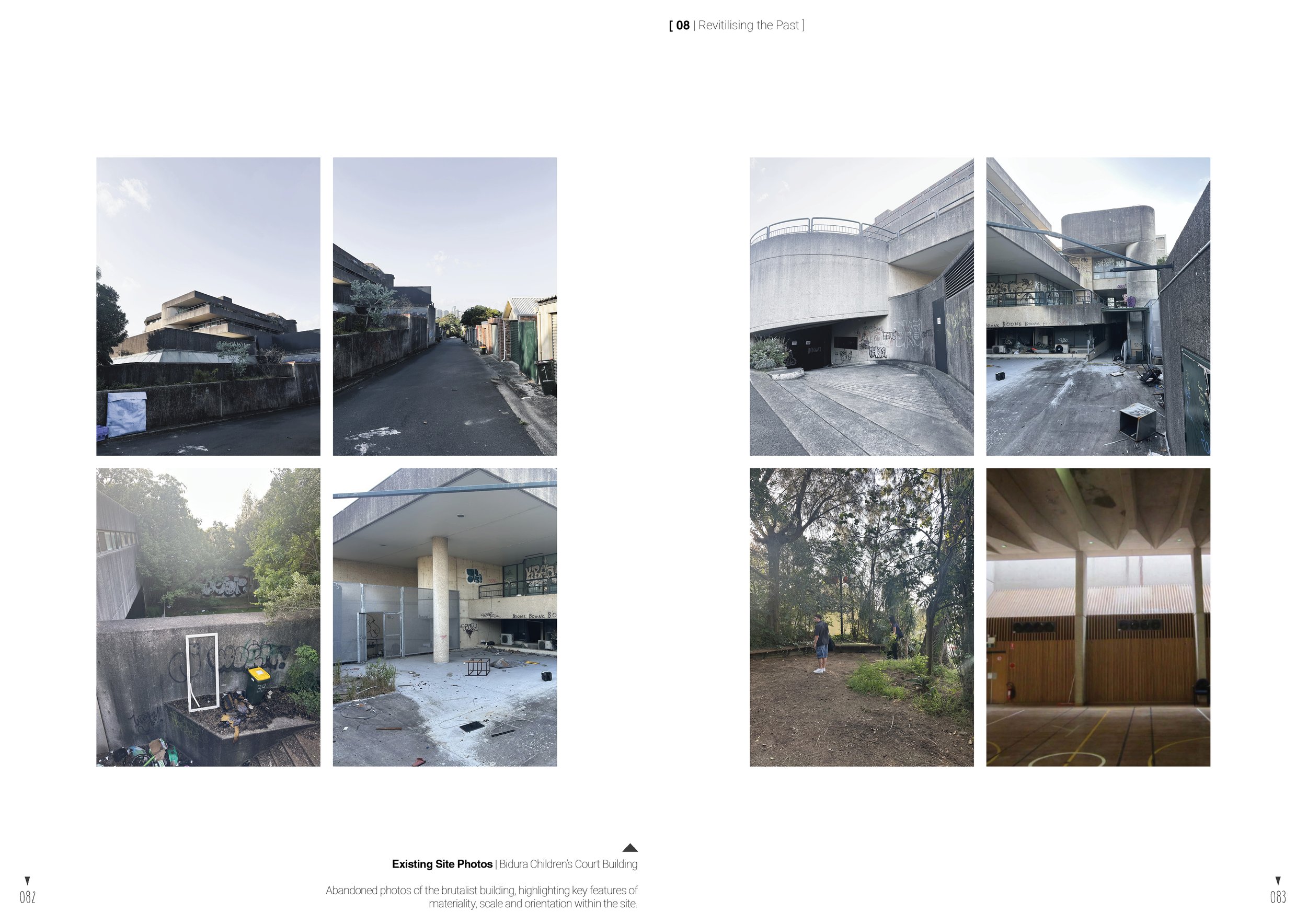
Existing Bidura Children’s Court
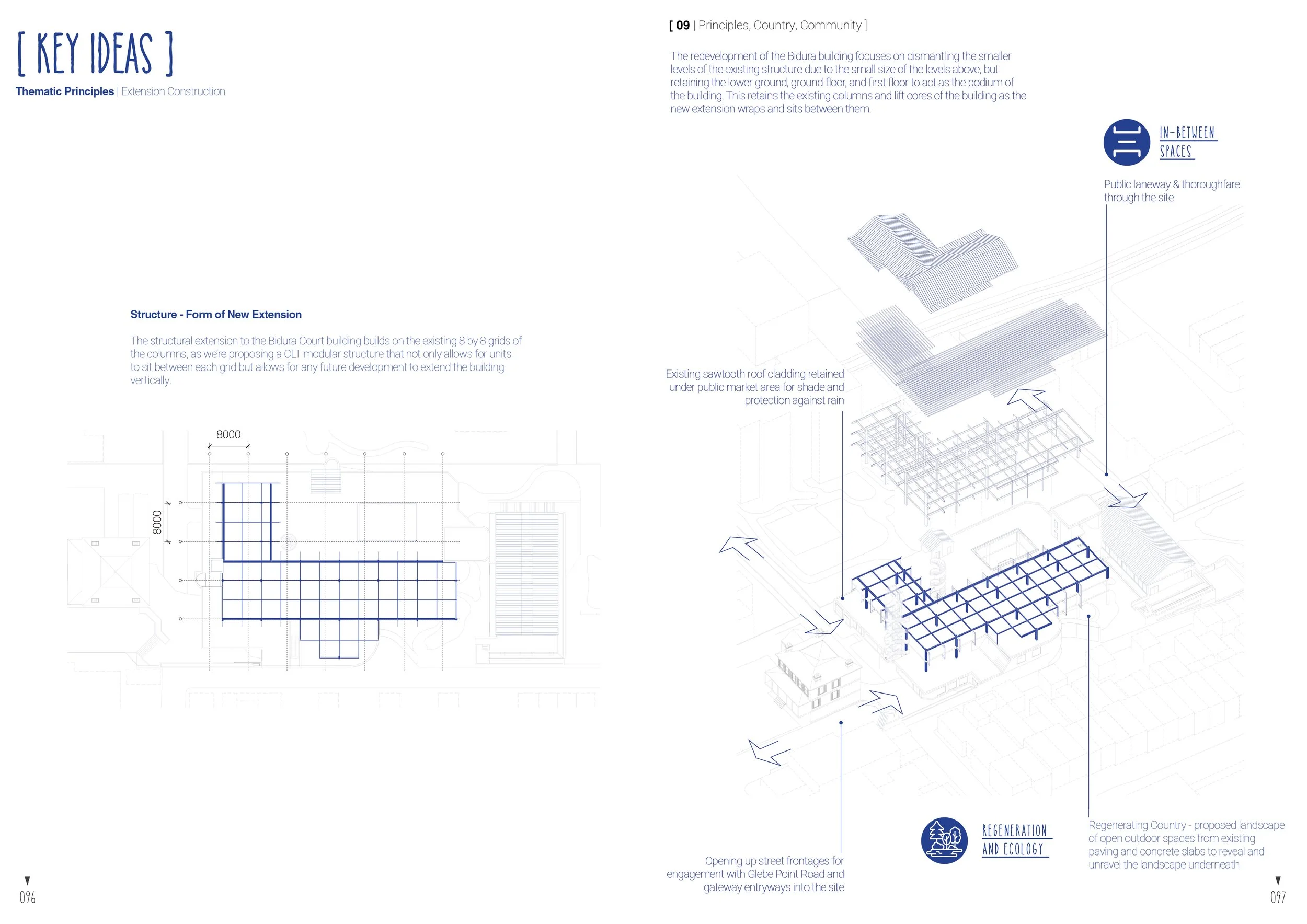
Principles, Country, Community
-
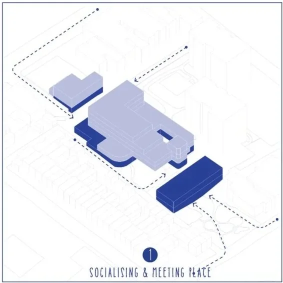
creating areas of socialising TO encourage meeting & connection to the wider community of Glebe
-
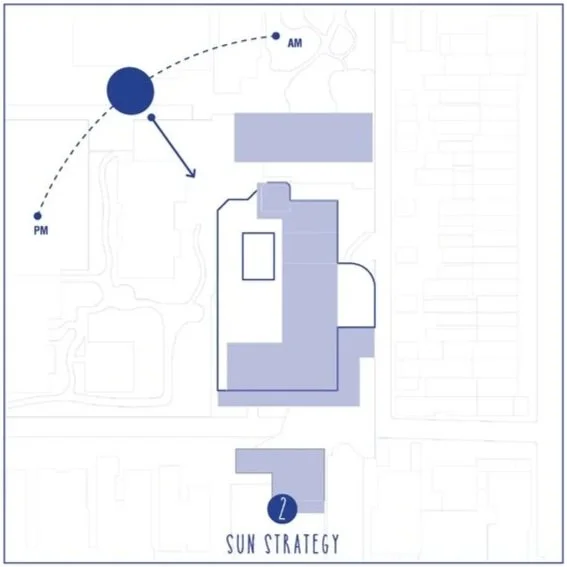
expose parts of the existing building TO allow natural sunlight to enter the spaces inside & between
-
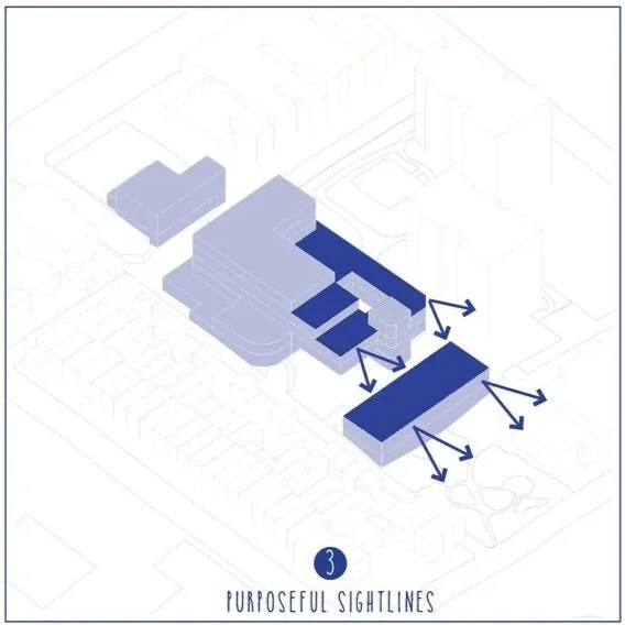
create an amphitheatre effect TO provide ample views towards Blackwattle Bay
-
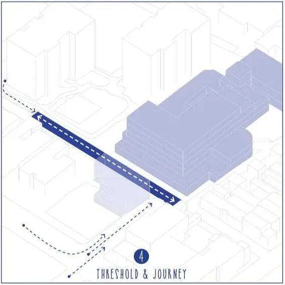
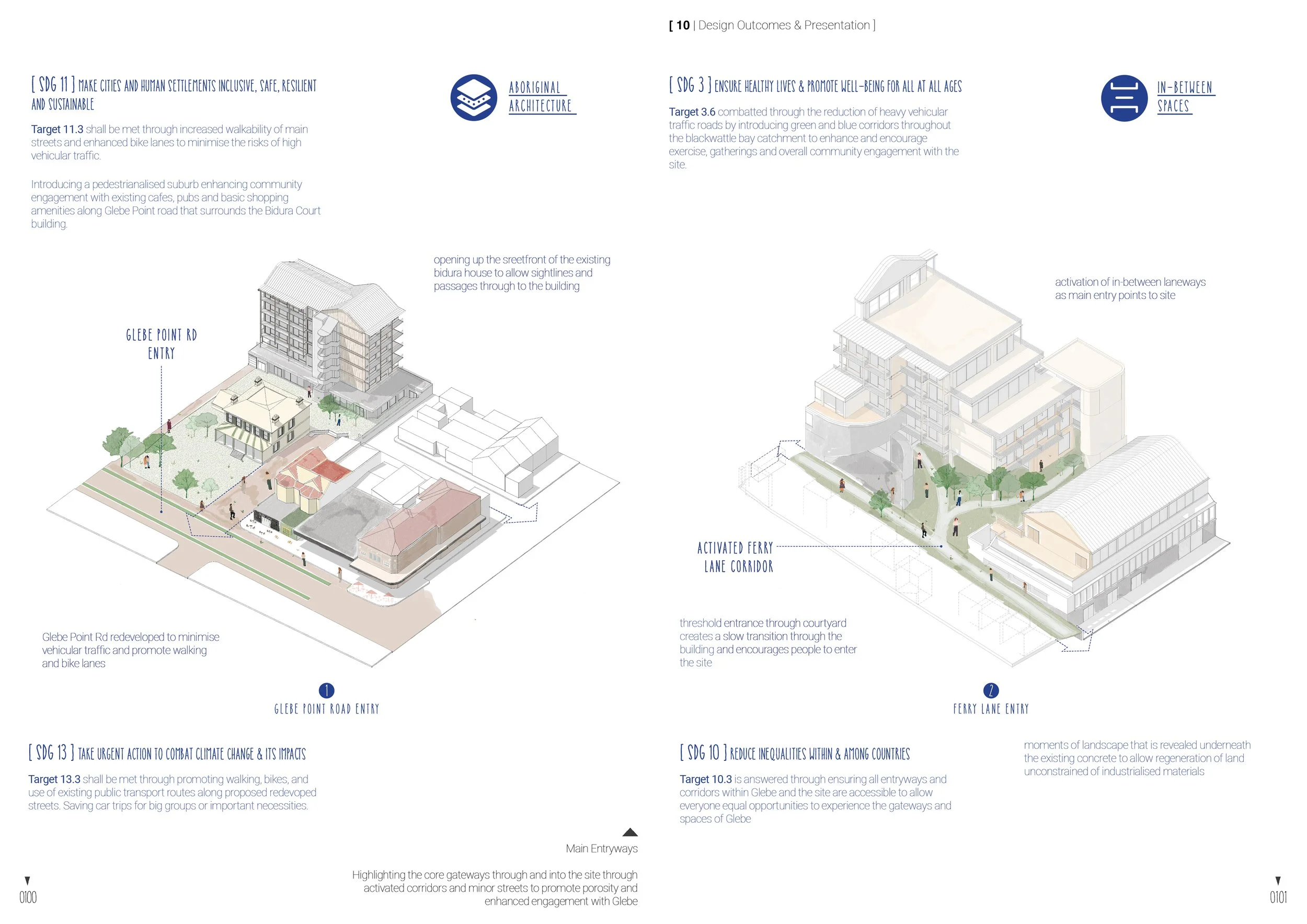
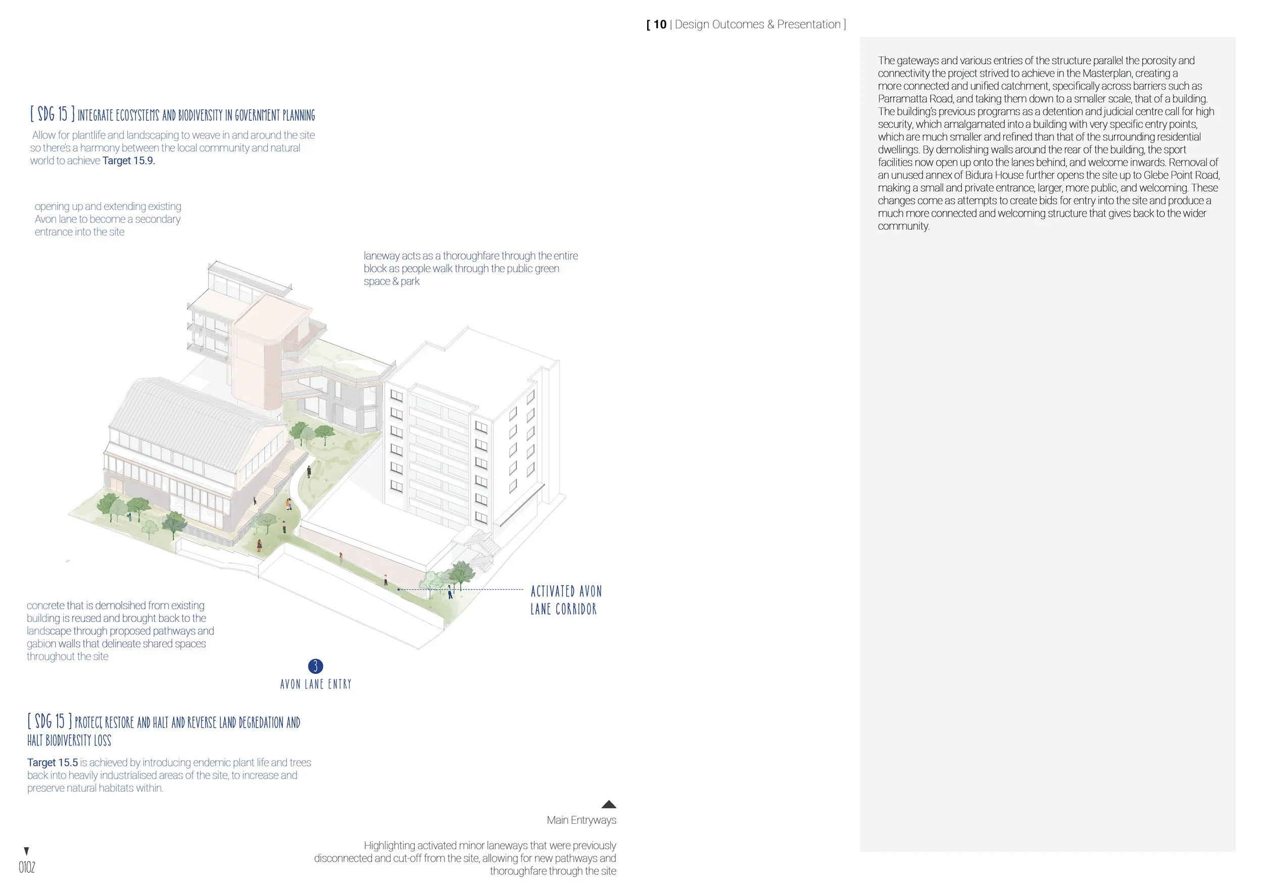
extend & introduce new laneways & entries TO increase porosity & transition people through the site
“The cultural expressions of First Nations peoples lie lightly over the landscape, expressed through pathways, campsites, [and] special places...”
- Danièle Hromek
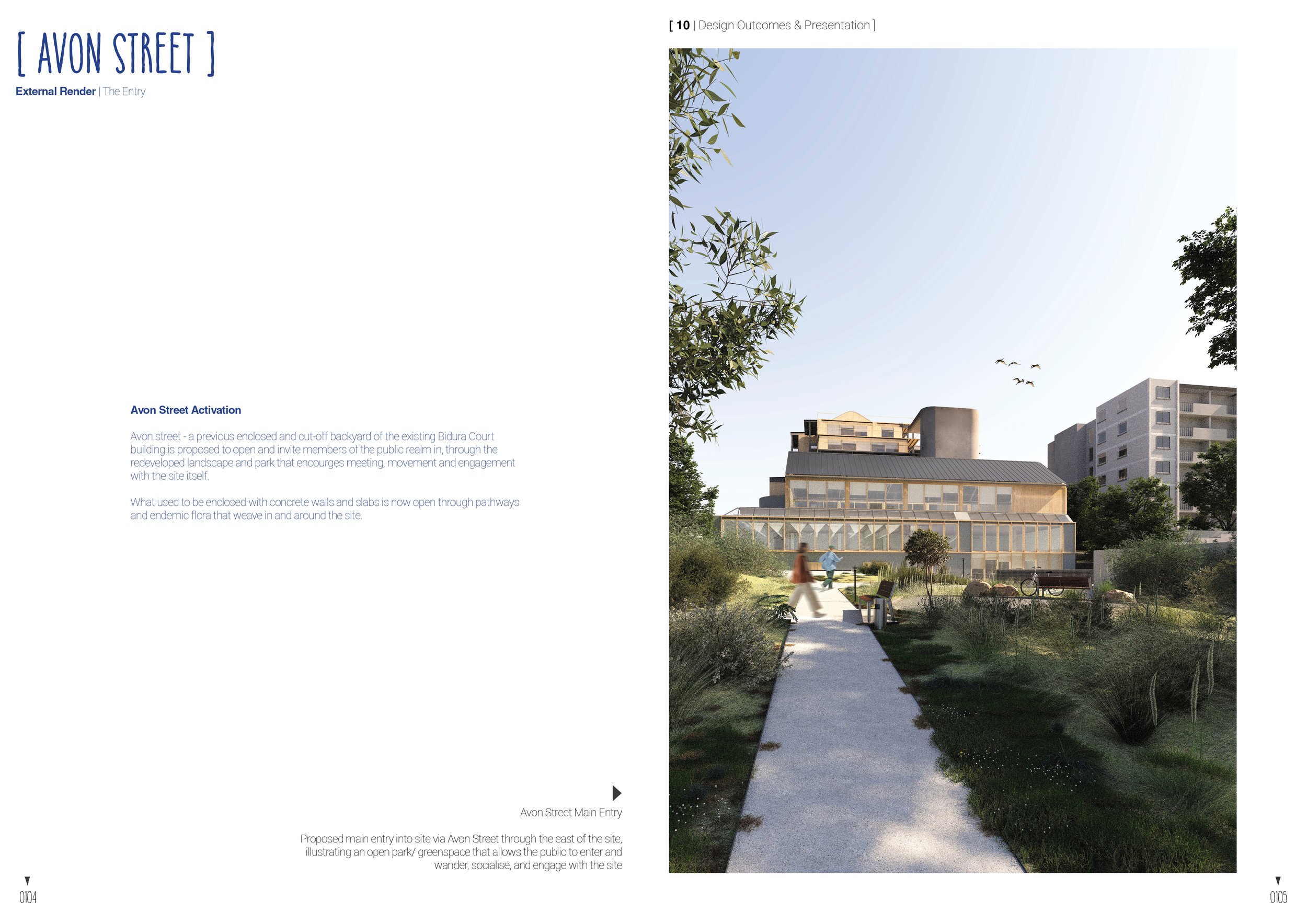
The emphasis of proposing and honing in on entryways and pathways that lead onto the site promote movement and porosity within the ground plane. It encourages streets to be activated and minor lanes to be celebrated.
BIDURA CHILDREN’S COURT REDEVELOPMENT
The court building began with the forefront Bidura House, which served as a receiving home for children entering the foster care system and awaiting placement. The facility played a major role in statewide children’s welfare until 1977.
There is a poetic misery imbedded the brutalist’s structure, a Children’s punishment and detention centre, built on the site of a Child Welfare home, built in a concrete brutalist form, on Church owned and named land, all on Gadigal country. It all harkens back to the stolen generation, stolen country, and the atrocities of the Colonial conquest of Australia’s history. This is a history that the project acknowledges with its program, with students being young people, we invite them onto site, and attempt to create a space that is their chosen home, welcoming, and a place of comfort, turning history anew.
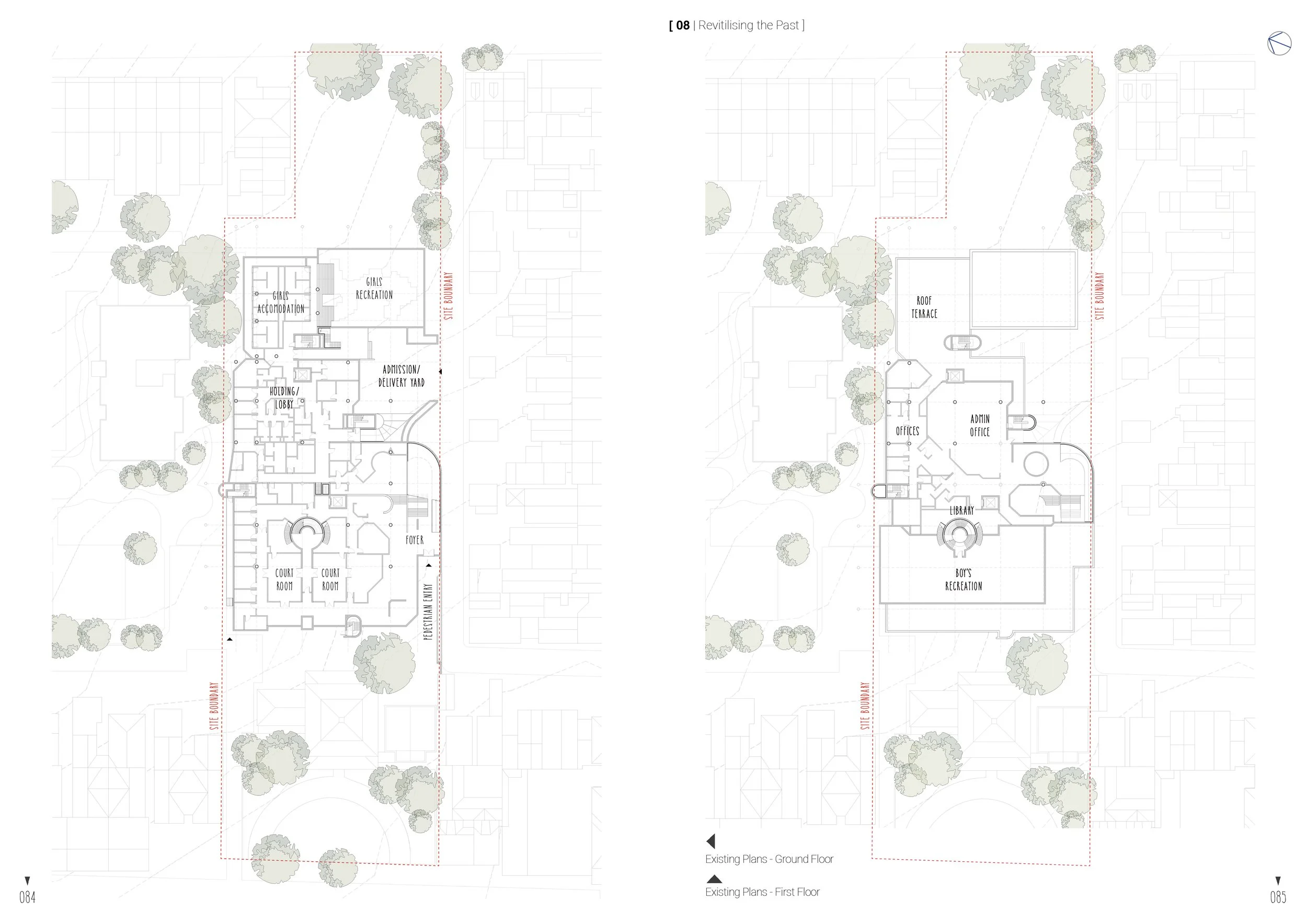
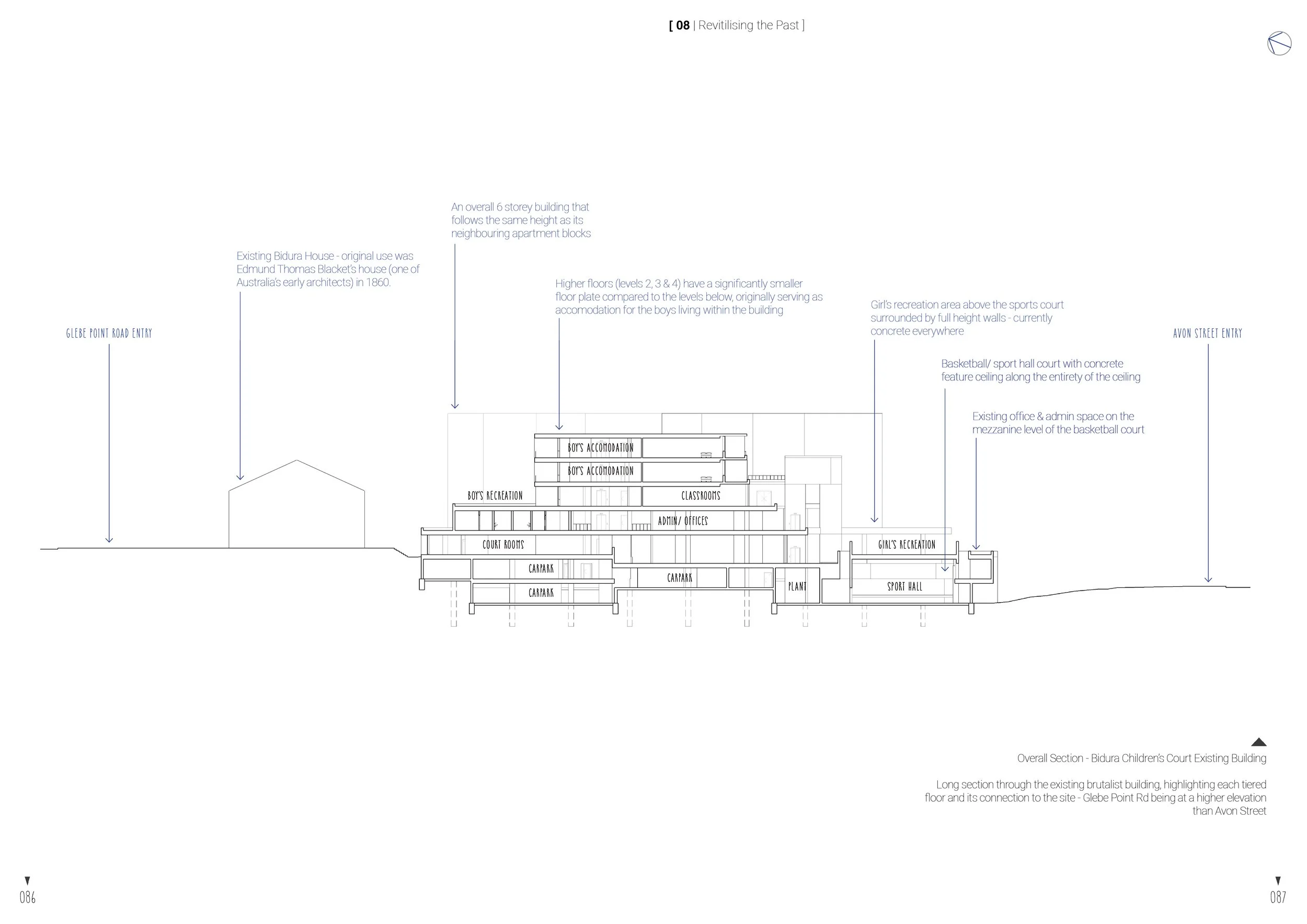
The structure lies on a grid, which allowed the project to find itself amongst the curves and walls of the original structure. The Buildings stepped form, however, made infill of the upper levels inefficient and unappealing, as such these layers were demolished, and the lower significantly larger half of the structure was made into a podium, upon which new development is situated. The project sees this as the perfect balance between usage of the onsite poured concrete, for the benefit of the environment and footprint, with the usage of the structure for function and space.
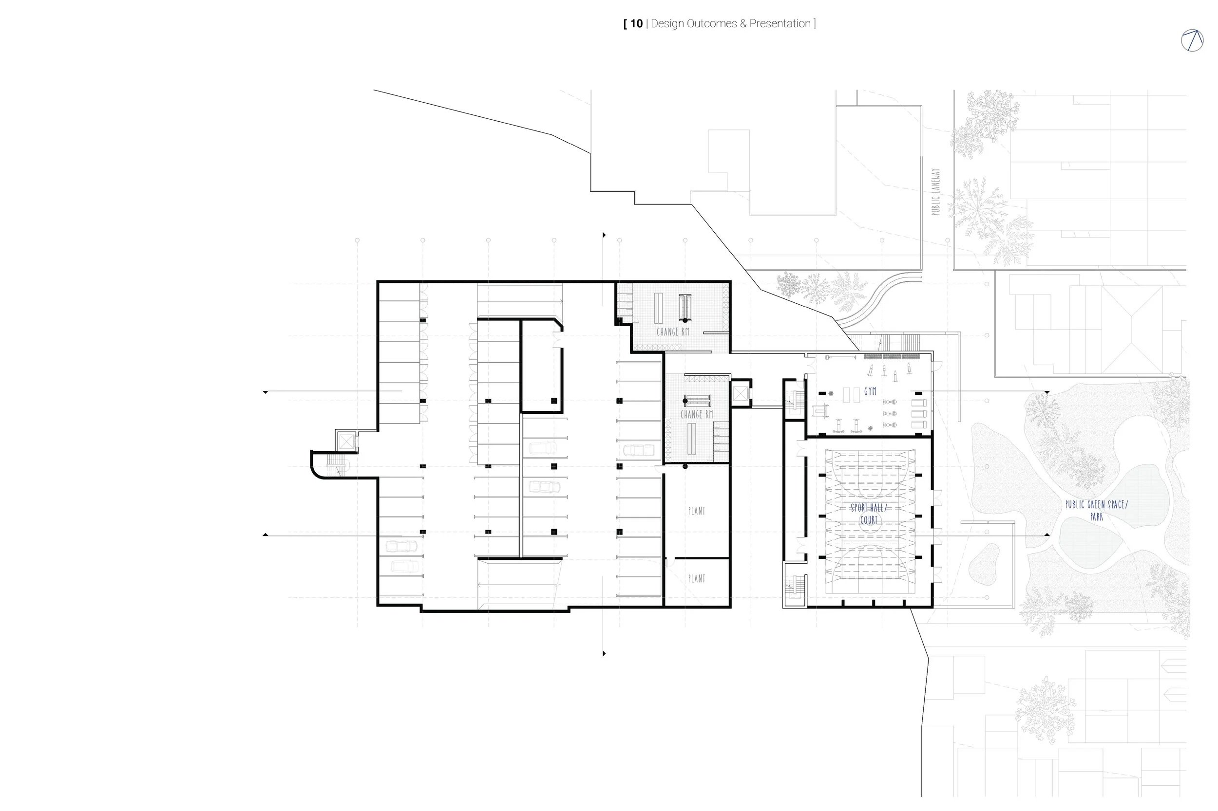
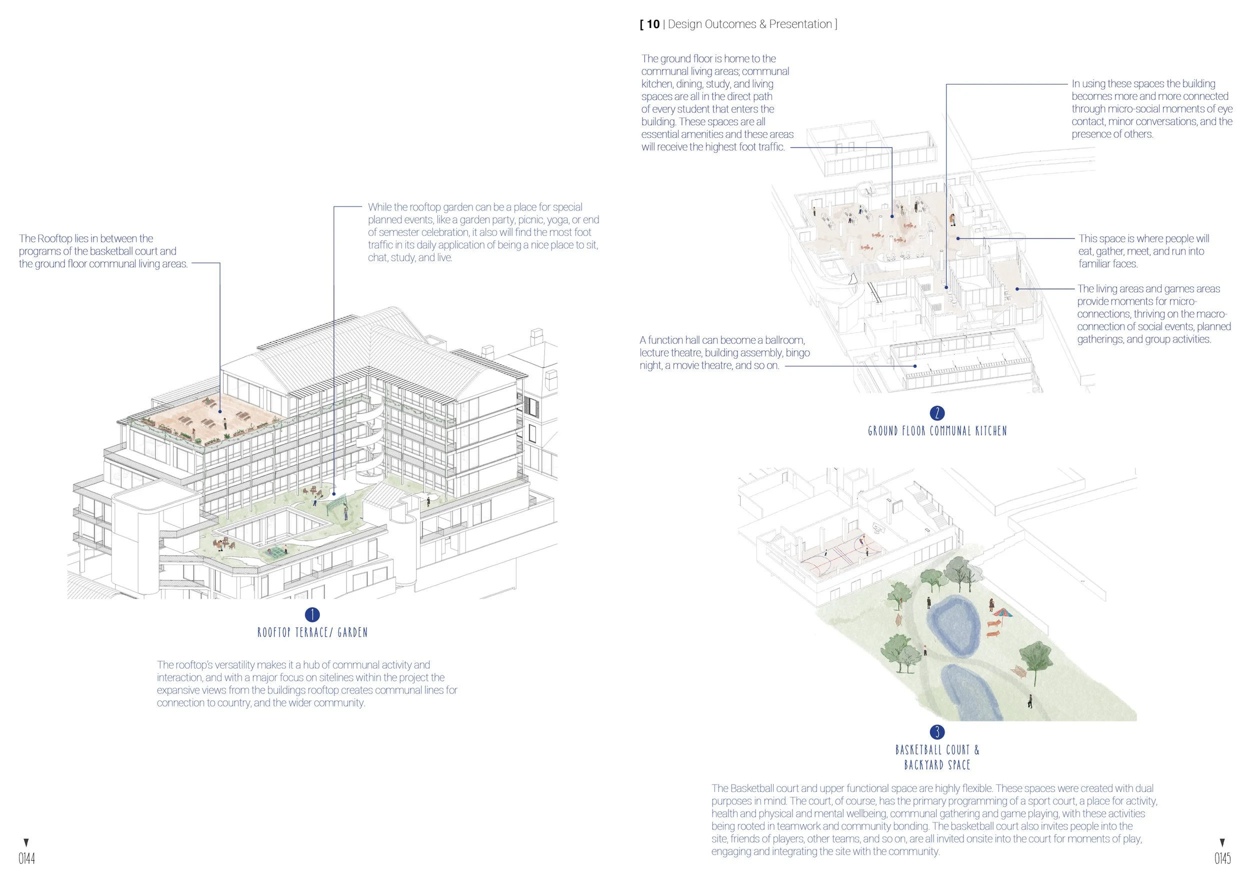
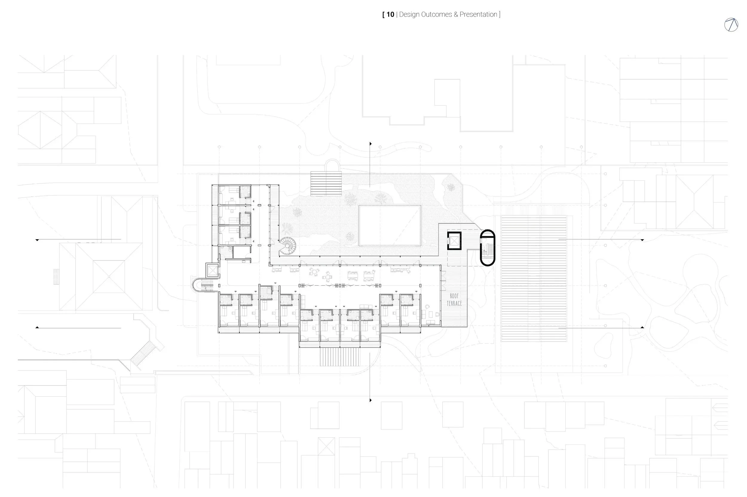
Lower Ground Floor
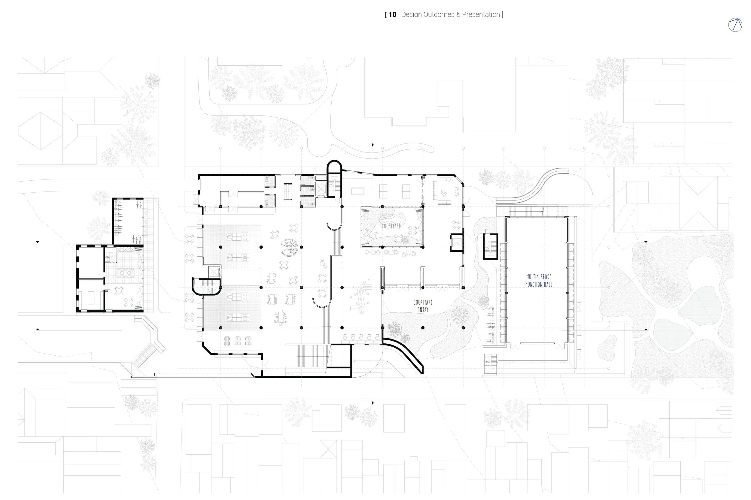
Ground Floor
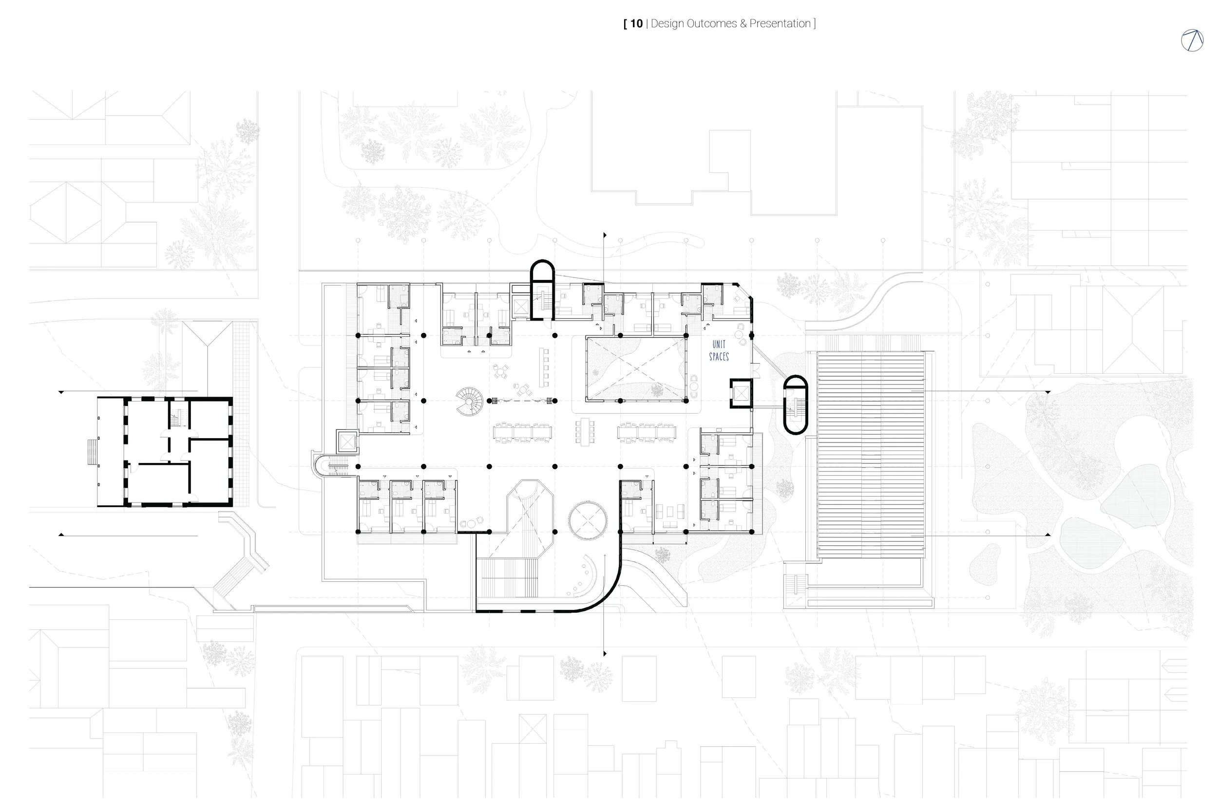
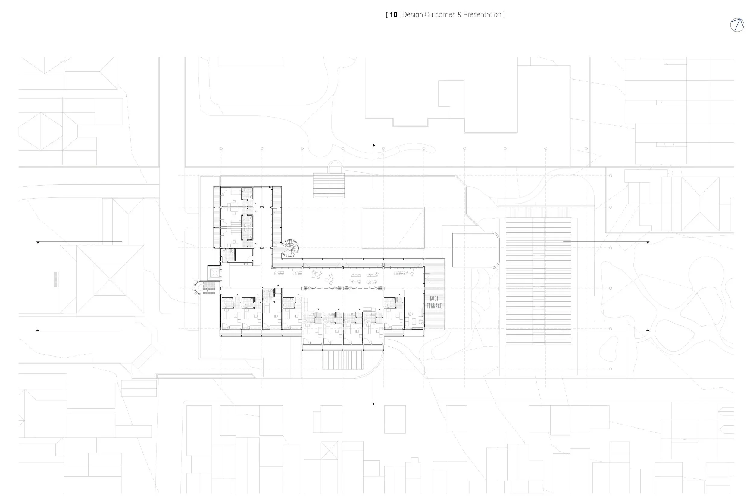
Level 01
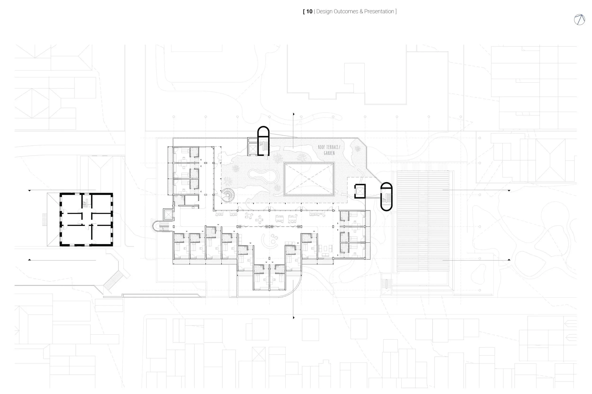
Level 02
Level 03
Level 04
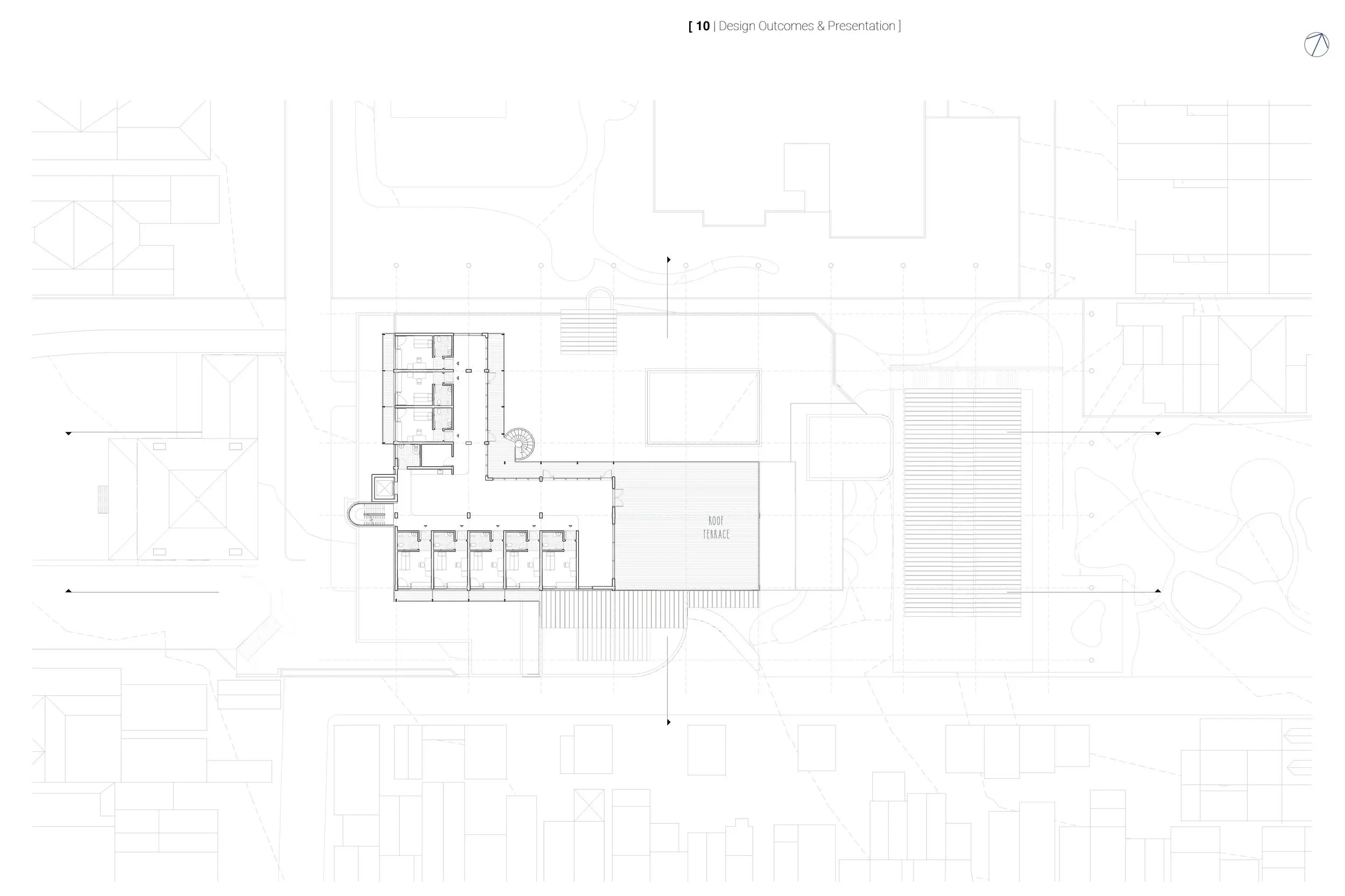
Level 05
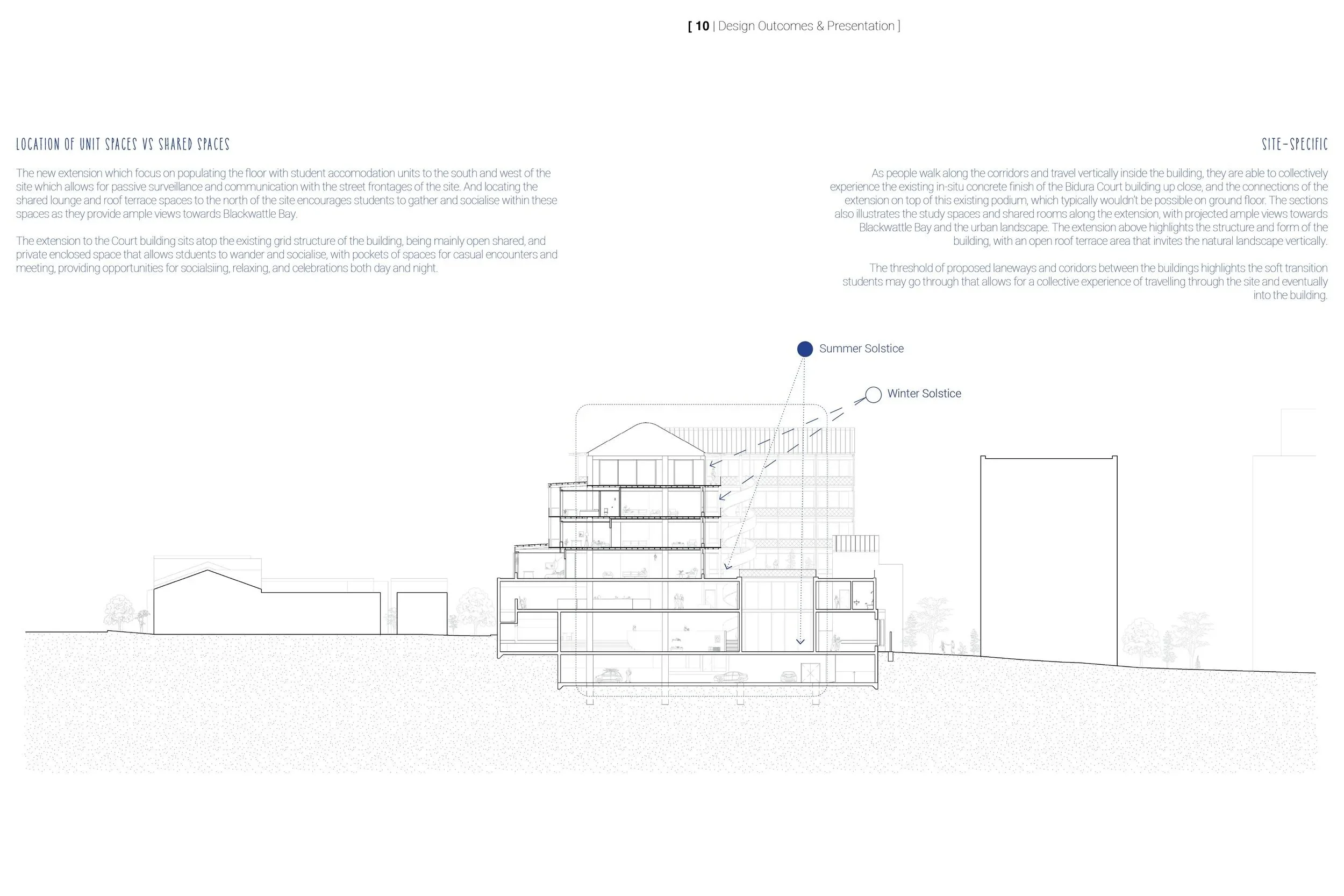
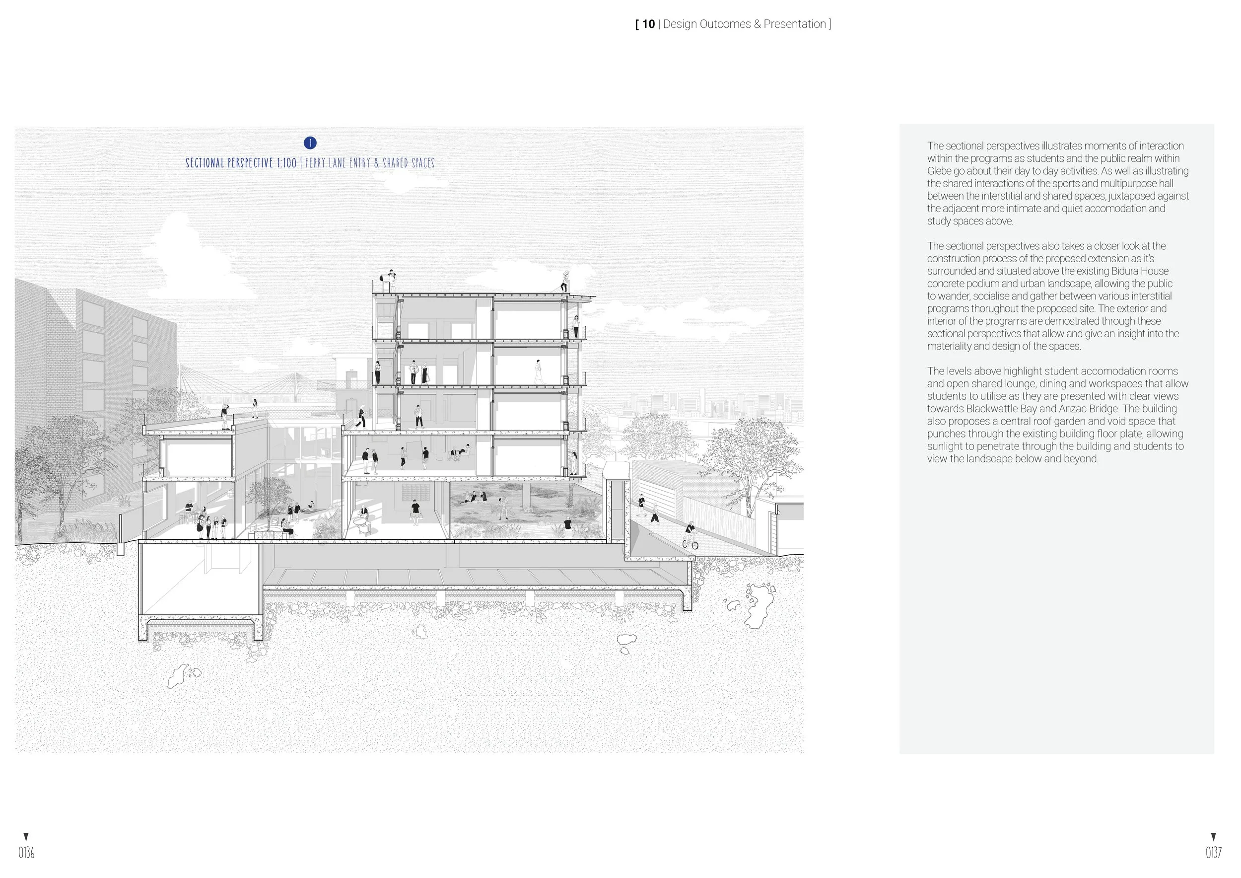
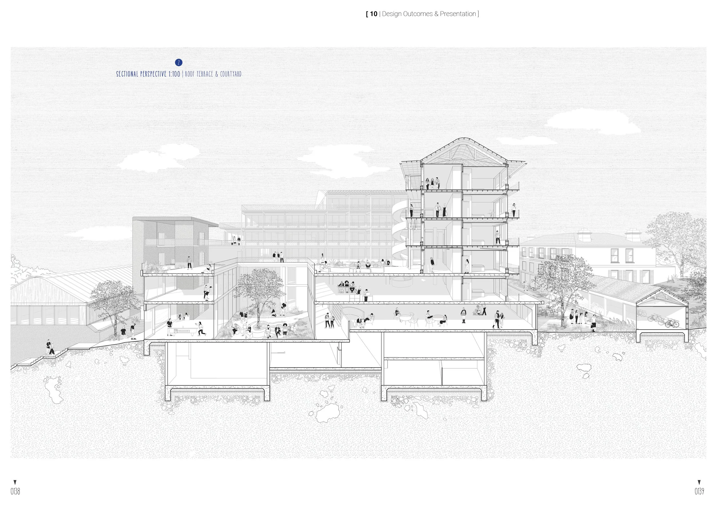
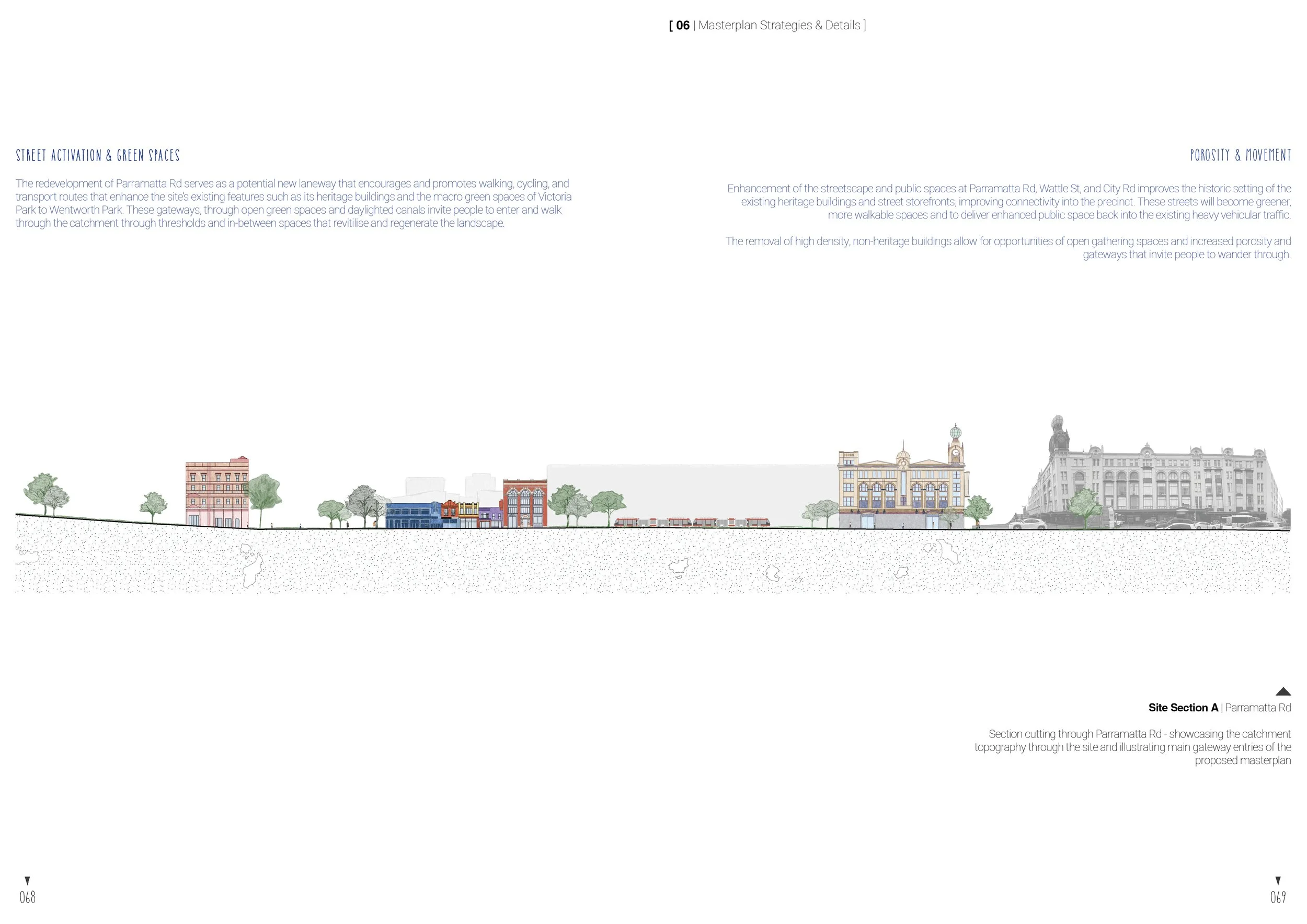
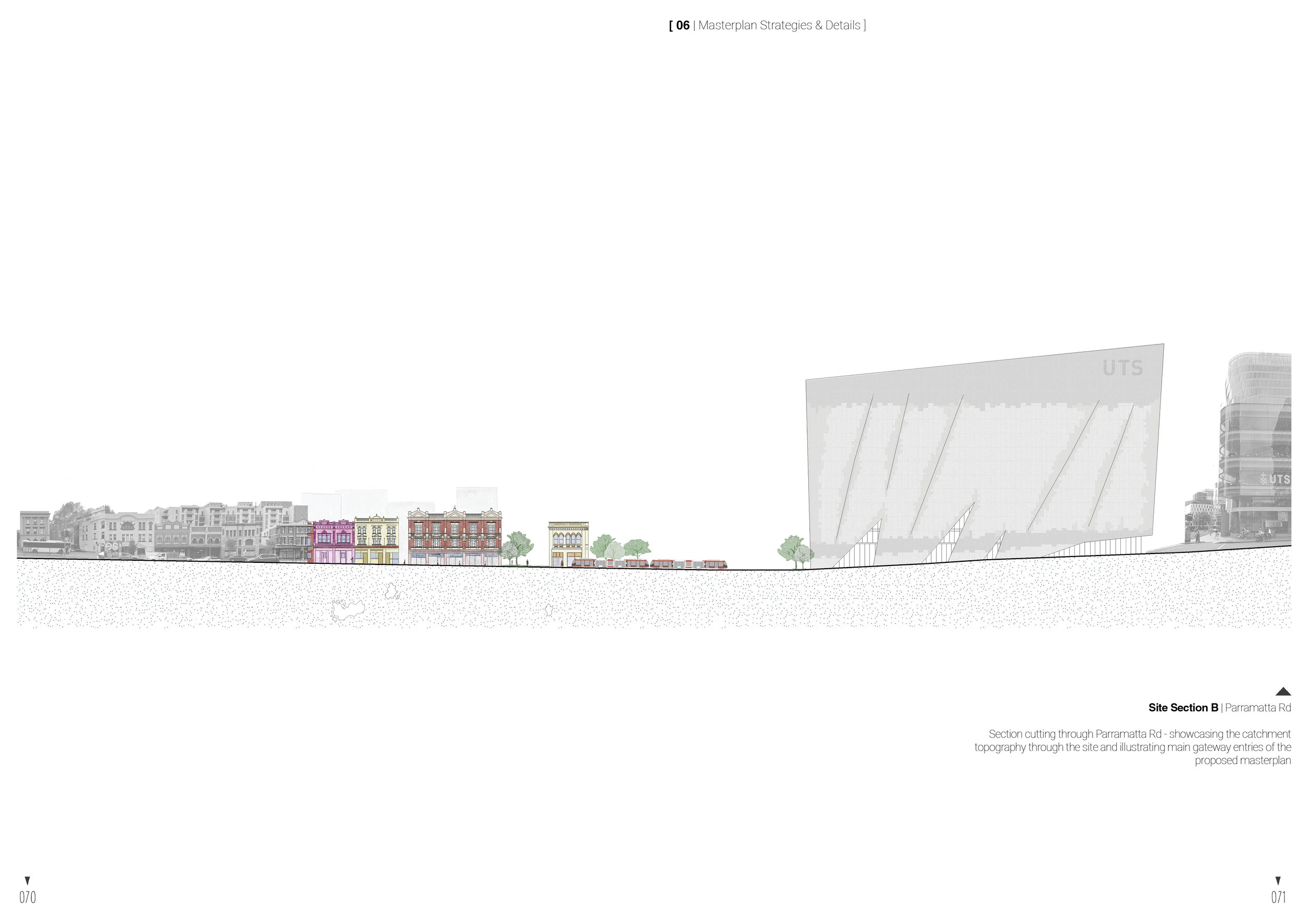
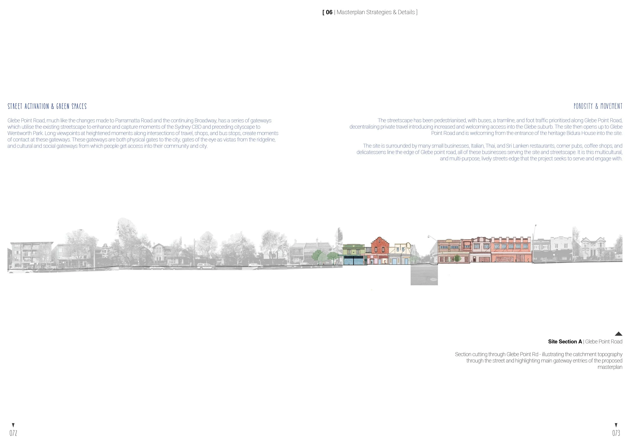
Overall Cross Section
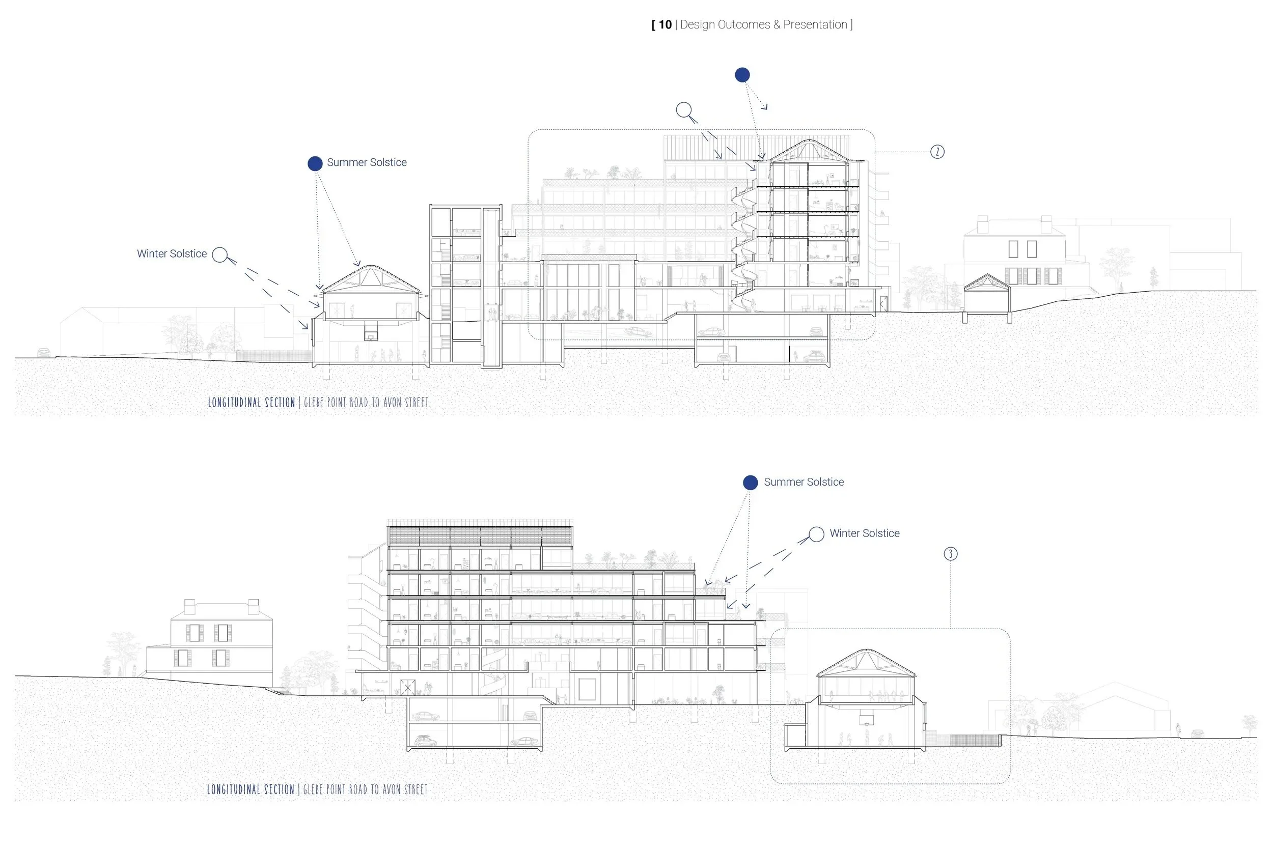
Overall Long Sections
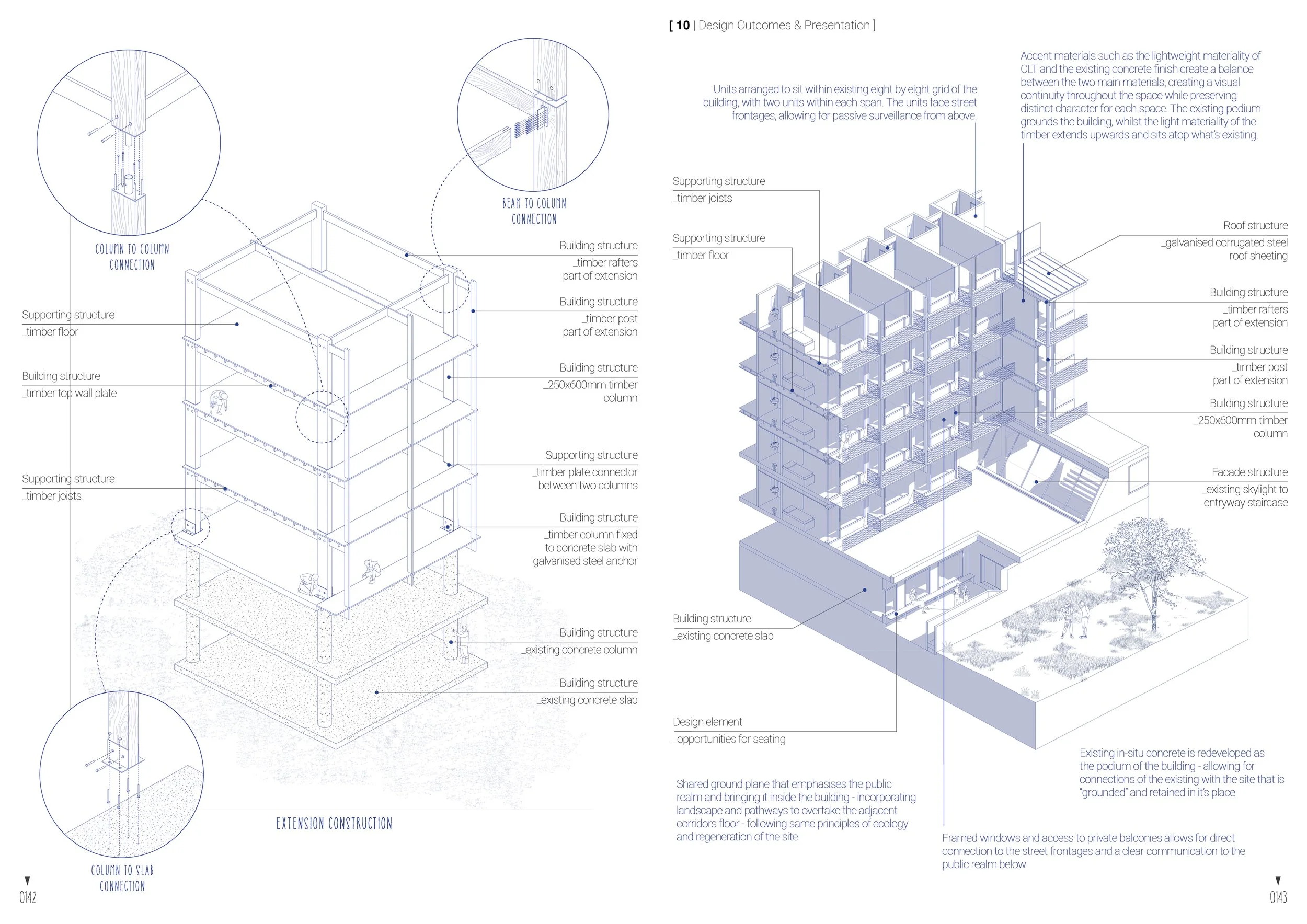
Decisive Details